Encyclopedia/3. History, Societies & Civilizations/09. Modern Nations/08. South Asia • Curated by Admin Timeline.sg
History of India, sourced from Wikipedia's "Timeline of Indian history".
Chronological Storyline (250 Milestones)
4000 BCE
Indus Valley Civilisation
Phase of the Indus Valley Civilisation begins. The civilization used an early form of the Indus signs, now called Indus script. Source — Wikipedia, "Timeline of Indian history" (50th–40th century BCE):
Sources: McIntosh, Jane (2008). The Ancient Indus Valley: New Perspectives. ISBN 978-1-57607-907-2. Background from http://www2.demis.nl/mapserver/mapper.asp By Avantiputra7 - Own work, CC BY-SA 3.0, https://commons.wikimedia.org/w/index.php?curid=33202416
2800 BCE
Harappa
The Indus Valley Civilization expand across the whole of modern-day Pakistan, much of northern India, and large parts of Afghanistan, with Harappa and Mohenjo-daro becoming large metropolises. Source — Wikipedia, "Timeline of Indian history" (30th–[[20th century BC|20th century BCE]]):
This is a photo of a monument in Pakistan identified as the By Muhammad Bin Naveed - Own work, CC BY-SA 3.0, https://commons.wikimedia.org/w/index.php?curid=35609614
2600 BCE
End of the Early Indus Valley
End of the Early Indus Valley Civilization culture. Start of Mature Indus Valley Civilization culture. Source — Wikipedia, "Timeline of Indian history" (30th–[[20th century BC|20th century BCE]]):
1900 BCE
End of Mature Indus Valley Civilization
End of Mature Indus Valley Civilization culture, late Indus Valley Civilization period starts. Source — Wikipedia, "Timeline of Indian history" ([[19th century BC|19th century BCE]]):
1800 BCE
Adichanallur
Adichanallur urn-burial site in Tirunelveli district in Tamil Nadu. In 2004, a number of skeletons dating from around 3,800 years ago. Source — Wikipedia, "Timeline of Indian history" ([[18th century BCE]]):
Urns in Adichanallur archaeological site By Balurbala - Own work, CC BY-SA 4.0, https://commons.wikimedia.org/w/index.php?curid=140420348
1700 BCE
Brihadratha
Brihadratha also known as Maharatha, was the initiator of the Brihadratha dynasty, the earliest ruling dynasty of Magadha according to the Puranas. Source — Wikipedia, "Timeline of Indian history" ([[17th century BC|17th century BCE]]):
Brihadratha By Avantiputra7 - Own work by Avantiputra7; see references section for used material, CC BY-SA 3.0, https://commons.wikimedia.org/w/index.php?curid=33202411
1680 BCE
Jarasandha
Jarasandha was the son of Brihadratha and became the 2nd ruler of the Barhadratha dynasty of Magadha succeeding his father. Source — Wikipedia, "Timeline of Indian history" ([[17th century BC|17th century BCE]]):
With Krishna in his yellow dhoti at lower left, Balabhadra depicted five times speaking and fighting with King Jarasandha, the army to the right and several onlookers in the background, all surrounded by red and blue borders, some figures with annotations By AnonymousUnknown author - A painting from the Mahabharata India, Kangra or Garhwal, circa 1810-20 Christie's, LotFinder: entry 5182903 (sale 2271, lot 1313, New York, 20 March 2009), Public domain, https://commons.wikimedia.org/w/index.php?curid=17143241
1665 BCE
Sahadeva of Magadha
Sahadeva of Magadha became the 3rd ruler of the Barhadratha dynasty of Magadha succeeding Jarasandha. Source — Wikipedia, "Timeline of Indian history" ([[17th century BC|17th century BCE]]):
Map of places mentioned in ancient Buddhist Texts (like Anguttara Nikaya), Ramayana and Mahabharata. Sources: (2005) The Hindu Equilibrium: India C.1500 B.C. - 2000 A.D., Oxford University Press, p. xxxviii ISBN: 978-0-19-927579-3. Approximate boundaries are described by H.C. Raychaudhuri (p. 96-150), and https://books.google.com/books?id=8qvY8pxVxcwC&pg=PA386 Habib, Irfan, and Habib, Faiz (1995). "A Map of India 600-320 B.C." in Proceedings of the Indian History Congress, vol. 56, pp. 95–104. www.jstor.org/stable/44158590 Kenoyer, J. M. (1995), “Interaction Systems, Specialised Crafts and Culture Change: The Indus Valley Tradition and the Indo-Gangetic Tradition in South Asia”, in G. Erdosy, The Indo-Aryans of Ancient South Asia: Language, Material Culture, and Ethnicity, Berlin: Walter de Gruyter, ISBN 9783110144475 Raychaudhuri, H.C. (1972), Political History of Ancient India: From the Accession of Parikshit to the Extinction of the Gupta Dynasty, Calcutta: University of Calcutta. Schwartzberg, J. E. (1992), A Historical Atlas of South Asia: University of Oxford Press Singh, U. (2009), A History of Ancient and Medieval India: From the Stone Age to the 12th Century, Delhi: Longman, ISBN 978-81-317-1677-9 Background from http://www2.demis.nl/mapserver/mapper.asp By Avantiputra7 - Own work, CC BY-SA 3.0, https://commons.wikimedia.org/w/index.php?curid=33202412
1661 BCE
Magadha
Somadhi became the 4th ruler of the Barhadratha dynasty of Magadha succeeding Sahadeva of Magadha. Source — Wikipedia, "Timeline of Indian history" ([[17th century BC|17th century BCE]]):
Map of places mentioned in ancient Buddhist Texts (like Anguttara Nikaya), Ramayana and Mahabharata. Sources: (2005) The Hindu Equilibrium: India C.1500 B.C. - 2000 A.D., Oxford University Press, p. xxxviii ISBN: 978-0-19-927579-3. Approximate boundaries are described by H.C. Raychaudhuri (p. 96-150), and https://books.google.com/books?id=8qvY8pxVxcwC&pg=PA386 Habib, Irfan, and Habib, Faiz (1995). "A Map of India 600-320 B.C." in Proceedings of the Indian History Congress, vol. 56, pp. 95–104. www.jstor.org/stable/44158590 Kenoyer, J. M. (1995), “Interaction Systems, Specialised Crafts and Culture Change: The Indus Valley Tradition and the Indo-Gangetic Tradition in South Asia”, in G. Erdosy, The Indo-Aryans of Ancient South Asia: Language, Material Culture, and Ethnicity, Berlin: Walter de Gruyter, ISBN 9783110144475 Raychaudhuri, H.C. (1972), Political History of Ancient India: From the Accession of Parikshit to the Extinction of the Gupta Dynasty, Calcutta: University of Calcutta. Schwartzberg, J. E. (1992), A Historical Atlas of South Asia: University of Oxford Press Singh, U. (2009), A History of Ancient and Medieval India: From the Stone Age to the 12th Century, Delhi: Longman, ISBN 978-81-317-1677-9 Background from http://www2.demis.nl/mapserver/mapper.asp By Avantiputra7 - Own work, CC BY-SA 3.0, https://commons.wikimedia.org/w/index.php?curid=33202412
1603 BCE
Magadha
Srutasravas became the 5th ruler of the Barhadratha dynasty of Magadha succeeding Somadhi. Source — Wikipedia, "Timeline of Indian history" ([[17th century BC|17th century BCE]]):
Map of places mentioned in ancient Buddhist Texts (like Anguttara Nikaya), Ramayana and Mahabharata. Sources: (2005) The Hindu Equilibrium: India C.1500 B.C. - 2000 A.D., Oxford University Press, p. xxxviii ISBN: 978-0-19-927579-3. Approximate boundaries are described by H.C. Raychaudhuri (p. 96-150), and https://books.google.com/books?id=8qvY8pxVxcwC&pg=PA386 Habib, Irfan, and Habib, Faiz (1995). "A Map of India 600-320 B.C." in Proceedings of the Indian History Congress, vol. 56, pp. 95–104. www.jstor.org/stable/44158590 Kenoyer, J. M. (1995), “Interaction Systems, Specialised Crafts and Culture Change: The Indus Valley Tradition and the Indo-Gangetic Tradition in South Asia”, in G. Erdosy, The Indo-Aryans of Ancient South Asia: Language, Material Culture, and Ethnicity, Berlin: Walter de Gruyter, ISBN 9783110144475 Raychaudhuri, H.C. (1972), Political History of Ancient India: From the Accession of Parikshit to the Extinction of the Gupta Dynasty, Calcutta: University of Calcutta. Schwartzberg, J. E. (1992), A Historical Atlas of South Asia: University of Oxford Press Singh, U. (2009), A History of Ancient and Medieval India: From the Stone Age to the 12th Century, Delhi: Longman, ISBN 978-81-317-1677-9 Background from http://www2.demis.nl/mapserver/mapper.asp By Avantiputra7 - Own work, CC BY-SA 3.0, https://commons.wikimedia.org/w/index.php?curid=33202412
1539 BCE
Magadha
Ayutayus became the 6th ruler of the Barhadratha dynasty of Magadha succeeding Srutasravas. Source — Wikipedia, "Timeline of Indian history" ([[16th century BCE]]):
Map of places mentioned in ancient Buddhist Texts (like Anguttara Nikaya), Ramayana and Mahabharata. Sources: (2005) The Hindu Equilibrium: India C.1500 B.C. - 2000 A.D., Oxford University Press, p. xxxviii ISBN: 978-0-19-927579-3. Approximate boundaries are described by H.C. Raychaudhuri (p. 96-150), and https://books.google.com/books?id=8qvY8pxVxcwC&pg=PA386 Habib, Irfan, and Habib, Faiz (1995). "A Map of India 600-320 B.C." in Proceedings of the Indian History Congress, vol. 56, pp. 95–104. www.jstor.org/stable/44158590 Kenoyer, J. M. (1995), “Interaction Systems, Specialised Crafts and Culture Change: The Indus Valley Tradition and the Indo-Gangetic Tradition in South Asia”, in G. Erdosy, The Indo-Aryans of Ancient South Asia: Language, Material Culture, and Ethnicity, Berlin: Walter de Gruyter, ISBN 9783110144475 Raychaudhuri, H.C. (1972), Political History of Ancient India: From the Accession of Parikshit to the Extinction of the Gupta Dynasty, Calcutta: University of Calcutta. Schwartzberg, J. E. (1992), A Historical Atlas of South Asia: University of Oxford Press Singh, U. (2009), A History of Ancient and Medieval India: From the Stone Age to the 12th Century, Delhi: Longman, ISBN 978-81-317-1677-9 Background from http://www2.demis.nl/mapserver/mapper.asp By Avantiputra7 - Own work, CC BY-SA 3.0, https://commons.wikimedia.org/w/index.php?curid=33202412
1503 BCE
Niramitra
Niramitra became the 7th ruler of the Barhadratha dynasty of Magadha succeeding Ayutayus. Source — Wikipedia, "Timeline of Indian history" ([[16th century BCE]]):
An Illustration from the Mahabharata: The Shakuni the king of Gandhar and the price of Hastinapur had a plan of the game dice.They need to win the game to insert Draupadi the kulavadu of Hastinapur. With the blind king Dhritarashtra flanked by the Kauravs seated in a golden pavilion, the Pandavas at left in the foreground with heads bowed in shame as their wife is stripped of her garments, Krishna's miracle illustrated by the multiple lengths of cloth at her feet Opaque pigments with gold on wasli 9¼ x 11¾ in. (30.4 x 29.8 cm.), framed Notes: Property from a private collection, Michigan Draupadi's cheer-haran, literally meaning stripping of one's clothes, marks a definitive moment in the story of Mahabharata. Her husbands, the Pandavas are tricked by their cousins, the Kauravas, into a fixed game of dice in which they lose their all their wealth and kingdom. Yudhishthira, the eldest and most-respected Pandava, is then goaded into gambling away each brother. Still the Kauravas are not satisfied by this humiliation, so they taunt Yudhishthira further into betting his wife. Against the protests of the family elders, who argue a woman cannot be put at stake, Yudhishthira puts Draupadi as a bet for the next round. When the Kauravas win, the eldest one Duryodhana, commands his younger brother Dushasana to forcefully bring her to the gathering. Dushasana drags her into the court by her hair. Drunk with power, Dushasana tries to strip Draupadi of her sari. Seeing her husbands unable or unwilling to help her, Draupadi prays to Lord Krishna to protect her. As Dushasana unwraps layers and layers of her sari, it keeps getting extended. Finally, a tired Dushasana backs off without being able to remove her clothing. Given this final insult that Draupadi faced, the younger Pandavas break their silence and vow to avenge these and further humiliations, which culminates in the epic battle, the Mahabharata. By Unknown author - http://www.artfact.com/auction-lot/an-illustration-from-the-mahabharata:-the-humili-860-c-0e4ee3d51b, Public domain, https://commons.wikimedia.org/w/index.php?curid=28437579
1500 BCE
Vedic period
Early Vedic period (until 1000 BCE) begins. Source — Wikipedia, "Timeline of Indian history" ([[15th century BCE]]):
Vedic period By Avantiputra7 - Own work by Avantiputra7; see references section for used material, CC BY-SA 3.0, https://commons.wikimedia.org/w/index.php?curid=33202410
1463 BCE
Magadha
Sukshatra became the 8th ruler of the Barhadratha dynasty of Magadha succeeding Niramitra. Source — Wikipedia, "Timeline of Indian history" ([[15th century BCE]]):
Map of places mentioned in ancient Buddhist Texts (like Anguttara Nikaya), Ramayana and Mahabharata. Sources: (2005) The Hindu Equilibrium: India C.1500 B.C. - 2000 A.D., Oxford University Press, p. xxxviii ISBN: 978-0-19-927579-3. Approximate boundaries are described by H.C. Raychaudhuri (p. 96-150), and https://books.google.com/books?id=8qvY8pxVxcwC&pg=PA386 Habib, Irfan, and Habib, Faiz (1995). "A Map of India 600-320 B.C." in Proceedings of the Indian History Congress, vol. 56, pp. 95–104. www.jstor.org/stable/44158590 Kenoyer, J. M. (1995), “Interaction Systems, Specialised Crafts and Culture Change: The Indus Valley Tradition and the Indo-Gangetic Tradition in South Asia”, in G. Erdosy, The Indo-Aryans of Ancient South Asia: Language, Material Culture, and Ethnicity, Berlin: Walter de Gruyter, ISBN 9783110144475 Raychaudhuri, H.C. (1972), Political History of Ancient India: From the Accession of Parikshit to the Extinction of the Gupta Dynasty, Calcutta: University of Calcutta. Schwartzberg, J. E. (1992), A Historical Atlas of South Asia: University of Oxford Press Singh, U. (2009), A History of Ancient and Medieval India: From the Stone Age to the 12th Century, Delhi: Longman, ISBN 978-81-317-1677-9 Background from http://www2.demis.nl/mapserver/mapper.asp By Avantiputra7 - Own work, CC BY-SA 3.0, https://commons.wikimedia.org/w/index.php?curid=33202412
1405 BCE
Magadha
Brihatkarman became the 9th ruler of the Barhadratha dynasty of Magadha succeeding Sukshatra. Source — Wikipedia, "Timeline of Indian history" ([[15th century BCE]]):
Map of places mentioned in ancient Buddhist Texts (like Anguttara Nikaya), Ramayana and Mahabharata. Sources: (2005) The Hindu Equilibrium: India C.1500 B.C. - 2000 A.D., Oxford University Press, p. xxxviii ISBN: 978-0-19-927579-3. Approximate boundaries are described by H.C. Raychaudhuri (p. 96-150), and https://books.google.com/books?id=8qvY8pxVxcwC&pg=PA386 Habib, Irfan, and Habib, Faiz (1995). "A Map of India 600-320 B.C." in Proceedings of the Indian History Congress, vol. 56, pp. 95–104. www.jstor.org/stable/44158590 Kenoyer, J. M. (1995), “Interaction Systems, Specialised Crafts and Culture Change: The Indus Valley Tradition and the Indo-Gangetic Tradition in South Asia”, in G. Erdosy, The Indo-Aryans of Ancient South Asia: Language, Material Culture, and Ethnicity, Berlin: Walter de Gruyter, ISBN 9783110144475 Raychaudhuri, H.C. (1972), Political History of Ancient India: From the Accession of Parikshit to the Extinction of the Gupta Dynasty, Calcutta: University of Calcutta. Schwartzberg, J. E. (1992), A Historical Atlas of South Asia: University of Oxford Press Singh, U. (2009), A History of Ancient and Medieval India: From the Stone Age to the 12th Century, Delhi: Longman, ISBN 978-81-317-1677-9 Background from http://www2.demis.nl/mapserver/mapper.asp By Avantiputra7 - Own work, CC BY-SA 3.0, https://commons.wikimedia.org/w/index.php?curid=33202412
1400 BCE
Gopala Dynasty
Gopala Dynasty established by Gopa. Source — Wikipedia, "Timeline of Indian history" ([[14th century BC|14th century BCE]]):
A palm leaf folio from the Bendall Vamsavali, also known as the Gopala Raj Vamsavali, currently at the National Archives of Nepal By Unknown author - National Archives of Nepal, Public domain, https://commons.wikimedia.org/w/index.php?curid=182859192
1382 BCE
Magadha
Senajit became the 10th ruler of the Barhadratha dynasty of Magadha succeeding Brihatkarman. Source — Wikipedia, "Timeline of Indian history" ([[14th century BC|14th century BCE]]):
Map of places mentioned in ancient Buddhist Texts (like Anguttara Nikaya), Ramayana and Mahabharata. Sources: (2005) The Hindu Equilibrium: India C.1500 B.C. - 2000 A.D., Oxford University Press, p. xxxviii ISBN: 978-0-19-927579-3. Approximate boundaries are described by H.C. Raychaudhuri (p. 96-150), and https://books.google.com/books?id=8qvY8pxVxcwC&pg=PA386 Habib, Irfan, and Habib, Faiz (1995). "A Map of India 600-320 B.C." in Proceedings of the Indian History Congress, vol. 56, pp. 95–104. www.jstor.org/stable/44158590 Kenoyer, J. M. (1995), “Interaction Systems, Specialised Crafts and Culture Change: The Indus Valley Tradition and the Indo-Gangetic Tradition in South Asia”, in G. Erdosy, The Indo-Aryans of Ancient South Asia: Language, Material Culture, and Ethnicity, Berlin: Walter de Gruyter, ISBN 9783110144475 Raychaudhuri, H.C. (1972), Political History of Ancient India: From the Accession of Parikshit to the Extinction of the Gupta Dynasty, Calcutta: University of Calcutta. Schwartzberg, J. E. (1992), A Historical Atlas of South Asia: University of Oxford Press Singh, U. (2009), A History of Ancient and Medieval India: From the Stone Age to the 12th Century, Delhi: Longman, ISBN 978-81-317-1677-9 Background from http://www2.demis.nl/mapserver/mapper.asp By Avantiputra7 - Own work, CC BY-SA 3.0, https://commons.wikimedia.org/w/index.php?curid=33202412
1332 BCE
Magadha
Srutanjaya became the 11th ruler of the Barhadratha dynasty of Magadha succeeding Senajit. Source — Wikipedia, "Timeline of Indian history" ([[14th century BC|14th century BCE]]):
Map of places mentioned in ancient Buddhist Texts (like Anguttara Nikaya), Ramayana and Mahabharata. Sources: (2005) The Hindu Equilibrium: India C.1500 B.C. - 2000 A.D., Oxford University Press, p. xxxviii ISBN: 978-0-19-927579-3. Approximate boundaries are described by H.C. Raychaudhuri (p. 96-150), and https://books.google.com/books?id=8qvY8pxVxcwC&pg=PA386 Habib, Irfan, and Habib, Faiz (1995). "A Map of India 600-320 B.C." in Proceedings of the Indian History Congress, vol. 56, pp. 95–104. www.jstor.org/stable/44158590 Kenoyer, J. M. (1995), “Interaction Systems, Specialised Crafts and Culture Change: The Indus Valley Tradition and the Indo-Gangetic Tradition in South Asia”, in G. Erdosy, The Indo-Aryans of Ancient South Asia: Language, Material Culture, and Ethnicity, Berlin: Walter de Gruyter, ISBN 9783110144475 Raychaudhuri, H.C. (1972), Political History of Ancient India: From the Accession of Parikshit to the Extinction of the Gupta Dynasty, Calcutta: University of Calcutta. Schwartzberg, J. E. (1992), A Historical Atlas of South Asia: University of Oxford Press Singh, U. (2009), A History of Ancient and Medieval India: From the Stone Age to the 12th Century, Delhi: Longman, ISBN 978-81-317-1677-9 Background from http://www2.demis.nl/mapserver/mapper.asp By Avantiputra7 - Own work, CC BY-SA 3.0, https://commons.wikimedia.org/w/index.php?curid=33202412
1300 BCE
Cemetery H culture
Indus Valley Civilization and Cemetery H culture comes to an end. Source — Wikipedia, "Timeline of Indian history" ([[13th century BCE]]):
Cemetery H culture By Unknown author, CC BY-SA 3.0, https://commons.wikimedia.org/w/index.php?curid=883227
1292 BCE
Magadha
Vipra became the 12th ruler of the Barhadratha dynasty of Magadha succeeding Srutanjaya. Source — Wikipedia, "Timeline of Indian history" ([[13th century BCE]]):
Map of places mentioned in ancient Buddhist Texts (like Anguttara Nikaya), Ramayana and Mahabharata. Sources: (2005) The Hindu Equilibrium: India C.1500 B.C. - 2000 A.D., Oxford University Press, p. xxxviii ISBN: 978-0-19-927579-3. Approximate boundaries are described by H.C. Raychaudhuri (p. 96-150), and https://books.google.com/books?id=8qvY8pxVxcwC&pg=PA386 Habib, Irfan, and Habib, Faiz (1995). "A Map of India 600-320 B.C." in Proceedings of the Indian History Congress, vol. 56, pp. 95–104. www.jstor.org/stable/44158590 Kenoyer, J. M. (1995), “Interaction Systems, Specialised Crafts and Culture Change: The Indus Valley Tradition and the Indo-Gangetic Tradition in South Asia”, in G. Erdosy, The Indo-Aryans of Ancient South Asia: Language, Material Culture, and Ethnicity, Berlin: Walter de Gruyter, ISBN 9783110144475 Raychaudhuri, H.C. (1972), Political History of Ancient India: From the Accession of Parikshit to the Extinction of the Gupta Dynasty, Calcutta: University of Calcutta. Schwartzberg, J. E. (1992), A Historical Atlas of South Asia: University of Oxford Press Singh, U. (2009), A History of Ancient and Medieval India: From the Stone Age to the 12th Century, Delhi: Longman, ISBN 978-81-317-1677-9 Background from http://www2.demis.nl/mapserver/mapper.asp By Avantiputra7 - Own work, CC BY-SA 3.0, https://commons.wikimedia.org/w/index.php?curid=33202412
1280 BCE
Pundravardhana
Pundravardhana Kingdom was established sometime before 1280 BCE. Source — Wikipedia, "Timeline of Indian history" ([[13th century BCE]]):
Ancient political divisions including historic Pundravardhana By user:P.K.Niyogi - Own map based on map in History of Ancient Bengal by Dr. R.C. Majumdar, first published 1971, reprint 2005, p. 10, Tulshi Prakashani, Kolkata, ISBN 81-89118-01-3 and other sources, CC BY-SA 3.0, https://commons.wikimedia.org/w/index.php?curid=3359766
1257 BCE
Magadha
Suchi became the 13th ruler of the Barhadratha dynasty of Magadha succeeding Vipra. Source — Wikipedia, "Timeline of Indian history" ([[13th century BCE]]):
Map of places mentioned in ancient Buddhist Texts (like Anguttara Nikaya), Ramayana and Mahabharata. Sources: (2005) The Hindu Equilibrium: India C.1500 B.C. - 2000 A.D., Oxford University Press, p. xxxviii ISBN: 978-0-19-927579-3. Approximate boundaries are described by H.C. Raychaudhuri (p. 96-150), and https://books.google.com/books?id=8qvY8pxVxcwC&pg=PA386 Habib, Irfan, and Habib, Faiz (1995). "A Map of India 600-320 B.C." in Proceedings of the Indian History Congress, vol. 56, pp. 95–104. www.jstor.org/stable/44158590 Kenoyer, J. M. (1995), “Interaction Systems, Specialised Crafts and Culture Change: The Indus Valley Tradition and the Indo-Gangetic Tradition in South Asia”, in G. Erdosy, The Indo-Aryans of Ancient South Asia: Language, Material Culture, and Ethnicity, Berlin: Walter de Gruyter, ISBN 9783110144475 Raychaudhuri, H.C. (1972), Political History of Ancient India: From the Accession of Parikshit to the Extinction of the Gupta Dynasty, Calcutta: University of Calcutta. Schwartzberg, J. E. (1992), A Historical Atlas of South Asia: University of Oxford Press Singh, U. (2009), A History of Ancient and Medieval India: From the Stone Age to the 12th Century, Delhi: Longman, ISBN 978-81-317-1677-9 Background from http://www2.demis.nl/mapserver/mapper.asp By Avantiputra7 - Own work, CC BY-SA 3.0, https://commons.wikimedia.org/w/index.php?curid=33202412
1200 BCE
Rigveda
Rigveda codified. The Kuru kingdom is established. Source — Wikipedia, "Timeline of Indian history" ([[12th century BCE]]):
Rigveda MS in Sanskrit on paper, India, early 19th c., 4 vols., 795 ff. (complete), 10x20 cm, single column, (7x17 cm), 10 lines in Devanagari script with deletions in yellow, Vedic accents, corrections etc in red. Binding: India, 19th c., blind-stamped brown leather, gilt spine, sewn on 5 cords, marbled endleaves Provenance: 1. Eames Collection, Chicago, no. 1956; 2. Newberry Library, Chicago, ORMS 960 (acq.no. 152851-152854) (ca. 1920-1994); 3. Sam Fogg cat. 17(1996):42. By Unknown author - http://www.nb.no/baser/schoyen/5/5.20/ms2097.jpg[dead link], Public domain, https://commons.wikimedia.org/w/index.php?curid=103513
1199 BCE
Magadha
Kshemya became the 14th ruler of the Barhadratha dynasty of Magadha succeeding Suchi. Source — Wikipedia, "Timeline of Indian history" ([[12th century BCE]]):
Map of places mentioned in ancient Buddhist Texts (like Anguttara Nikaya), Ramayana and Mahabharata. Sources: (2005) The Hindu Equilibrium: India C.1500 B.C. - 2000 A.D., Oxford University Press, p. xxxviii ISBN: 978-0-19-927579-3. Approximate boundaries are described by H.C. Raychaudhuri (p. 96-150), and https://books.google.com/books?id=8qvY8pxVxcwC&pg=PA386 Habib, Irfan, and Habib, Faiz (1995). "A Map of India 600-320 B.C." in Proceedings of the Indian History Congress, vol. 56, pp. 95–104. www.jstor.org/stable/44158590 Kenoyer, J. M. (1995), “Interaction Systems, Specialised Crafts and Culture Change: The Indus Valley Tradition and the Indo-Gangetic Tradition in South Asia”, in G. Erdosy, The Indo-Aryans of Ancient South Asia: Language, Material Culture, and Ethnicity, Berlin: Walter de Gruyter, ISBN 9783110144475 Raychaudhuri, H.C. (1972), Political History of Ancient India: From the Accession of Parikshit to the Extinction of the Gupta Dynasty, Calcutta: University of Calcutta. Schwartzberg, J. E. (1992), A Historical Atlas of South Asia: University of Oxford Press Singh, U. (2009), A History of Ancient and Medieval India: From the Stone Age to the 12th Century, Delhi: Longman, ISBN 978-81-317-1677-9 Background from http://www2.demis.nl/mapserver/mapper.asp By Avantiputra7 - Own work, CC BY-SA 3.0, https://commons.wikimedia.org/w/index.php?curid=33202412
1171 BCE
Magadha
Subrata became the 15th ruler of the Barhadratha dynasty of Magadha succeeding Kshemya. Source — Wikipedia, "Timeline of Indian history" ([[12th century BCE]]):
Map of places mentioned in ancient Buddhist Texts (like Anguttara Nikaya), Ramayana and Mahabharata. Sources: (2005) The Hindu Equilibrium: India C.1500 B.C. - 2000 A.D., Oxford University Press, p. xxxviii ISBN: 978-0-19-927579-3. Approximate boundaries are described by H.C. Raychaudhuri (p. 96-150), and https://books.google.com/books?id=8qvY8pxVxcwC&pg=PA386 Habib, Irfan, and Habib, Faiz (1995). "A Map of India 600-320 B.C." in Proceedings of the Indian History Congress, vol. 56, pp. 95–104. www.jstor.org/stable/44158590 Kenoyer, J. M. (1995), “Interaction Systems, Specialised Crafts and Culture Change: The Indus Valley Tradition and the Indo-Gangetic Tradition in South Asia”, in G. Erdosy, The Indo-Aryans of Ancient South Asia: Language, Material Culture, and Ethnicity, Berlin: Walter de Gruyter, ISBN 9783110144475 Raychaudhuri, H.C. (1972), Political History of Ancient India: From the Accession of Parikshit to the Extinction of the Gupta Dynasty, Calcutta: University of Calcutta. Schwartzberg, J. E. (1992), A Historical Atlas of South Asia: University of Oxford Press Singh, U. (2009), A History of Ancient and Medieval India: From the Stone Age to the 12th Century, Delhi: Longman, ISBN 978-81-317-1677-9 Background from http://www2.demis.nl/mapserver/mapper.asp By Avantiputra7 - Own work, CC BY-SA 3.0, https://commons.wikimedia.org/w/index.php?curid=33202412
1107 BCE
Magadha
Dharma became the 16th ruler of the Barhadratha dynasty of Magadha succeeding Subrata. Source — Wikipedia, "Timeline of Indian history" ([[12th century BCE]]):
Map of places mentioned in ancient Buddhist Texts (like Anguttara Nikaya), Ramayana and Mahabharata. Sources: (2005) The Hindu Equilibrium: India C.1500 B.C. - 2000 A.D., Oxford University Press, p. xxxviii ISBN: 978-0-19-927579-3. Approximate boundaries are described by H.C. Raychaudhuri (p. 96-150), and https://books.google.com/books?id=8qvY8pxVxcwC&pg=PA386 Habib, Irfan, and Habib, Faiz (1995). "A Map of India 600-320 B.C." in Proceedings of the Indian History Congress, vol. 56, pp. 95–104. www.jstor.org/stable/44158590 Kenoyer, J. M. (1995), “Interaction Systems, Specialised Crafts and Culture Change: The Indus Valley Tradition and the Indo-Gangetic Tradition in South Asia”, in G. Erdosy, The Indo-Aryans of Ancient South Asia: Language, Material Culture, and Ethnicity, Berlin: Walter de Gruyter, ISBN 9783110144475 Raychaudhuri, H.C. (1972), Political History of Ancient India: From the Accession of Parikshit to the Extinction of the Gupta Dynasty, Calcutta: University of Calcutta. Schwartzberg, J. E. (1992), A Historical Atlas of South Asia: University of Oxford Press Singh, U. (2009), A History of Ancient and Medieval India: From the Stone Age to the 12th Century, Delhi: Longman, ISBN 978-81-317-1677-9 Background from http://www2.demis.nl/mapserver/mapper.asp By Avantiputra7 - Own work, CC BY-SA 3.0, https://commons.wikimedia.org/w/index.php?curid=33202412
1043 BCE
Magadha
Dharma stepped down as the 16th ruler of the Barhadratha dynasty of Magadha. Source — Wikipedia, "Timeline of Indian history" ([[11th century BC|11th century BCE]]):
Map of places mentioned in ancient Buddhist Texts (like Anguttara Nikaya), Ramayana and Mahabharata. Sources: (2005) The Hindu Equilibrium: India C.1500 B.C. - 2000 A.D., Oxford University Press, p. xxxviii ISBN: 978-0-19-927579-3. Approximate boundaries are described by H.C. Raychaudhuri (p. 96-150), and https://books.google.com/books?id=8qvY8pxVxcwC&pg=PA386 Habib, Irfan, and Habib, Faiz (1995). "A Map of India 600-320 B.C." in Proceedings of the Indian History Congress, vol. 56, pp. 95–104. www.jstor.org/stable/44158590 Kenoyer, J. M. (1995), “Interaction Systems, Specialised Crafts and Culture Change: The Indus Valley Tradition and the Indo-Gangetic Tradition in South Asia”, in G. Erdosy, The Indo-Aryans of Ancient South Asia: Language, Material Culture, and Ethnicity, Berlin: Walter de Gruyter, ISBN 9783110144475 Raychaudhuri, H.C. (1972), Political History of Ancient India: From the Accession of Parikshit to the Extinction of the Gupta Dynasty, Calcutta: University of Calcutta. Schwartzberg, J. E. (1992), A Historical Atlas of South Asia: University of Oxford Press Singh, U. (2009), A History of Ancient and Medieval India: From the Stone Age to the 12th Century, Delhi: Longman, ISBN 978-81-317-1677-9 Background from http://www2.demis.nl/mapserver/mapper.asp By Avantiputra7 - Own work, CC BY-SA 3.0, https://commons.wikimedia.org/w/index.php?curid=33202412
1008 BCE
Magadha
Susuma became the 17th ruler of the Barhadratha dynasty of Magadha succeeding Dharma. Source — Wikipedia, "Timeline of Indian history" ([[11th century BC|11th century BCE]]):
Map of places mentioned in ancient Buddhist Texts (like Anguttara Nikaya), Ramayana and Mahabharata. Sources: (2005) The Hindu Equilibrium: India C.1500 B.C. - 2000 A.D., Oxford University Press, p. xxxviii ISBN: 978-0-19-927579-3. Approximate boundaries are described by H.C. Raychaudhuri (p. 96-150), and https://books.google.com/books?id=8qvY8pxVxcwC&pg=PA386 Habib, Irfan, and Habib, Faiz (1995). "A Map of India 600-320 B.C." in Proceedings of the Indian History Congress, vol. 56, pp. 95–104. www.jstor.org/stable/44158590 Kenoyer, J. M. (1995), “Interaction Systems, Specialised Crafts and Culture Change: The Indus Valley Tradition and the Indo-Gangetic Tradition in South Asia”, in G. Erdosy, The Indo-Aryans of Ancient South Asia: Language, Material Culture, and Ethnicity, Berlin: Walter de Gruyter, ISBN 9783110144475 Raychaudhuri, H.C. (1972), Political History of Ancient India: From the Accession of Parikshit to the Extinction of the Gupta Dynasty, Calcutta: University of Calcutta. Schwartzberg, J. E. (1992), A Historical Atlas of South Asia: University of Oxford Press Singh, U. (2009), A History of Ancient and Medieval India: From the Stone Age to the 12th Century, Delhi: Longman, ISBN 978-81-317-1677-9 Background from http://www2.demis.nl/mapserver/mapper.asp By Avantiputra7 - Own work, CC BY-SA 3.0, https://commons.wikimedia.org/w/index.php?curid=33202412
1000 BCE
Vedic period
Middle and Late Vedic period (to 500 BCE). Source — Wikipedia, "Timeline of Indian history" ([[10th century BCE]]):
Vedic period By Avantiputra7 - Own work by Avantiputra7; see references section for used material, CC BY-SA 3.0, https://commons.wikimedia.org/w/index.php?curid=33202410
1000 BCE
Megalith
Kanchi district, gold mine of Megalithic sites in Tamil Nadu, South India. Source — Wikipedia, "Timeline of Indian history" ([[10th century BCE]]):
Megalithic grave Harhoog located in Keitum on the island of Sylt in Schleswig-Holstein, Germany. The Harhoog is an extended dolmen, a type of megalithic tomb. It was built by the Funnelbeaker culture, probably around 3000 BC. It has been moved from its original location 1954. By Michael Gäbler - Own work, CC BY 3.0, https://commons.wikimedia.org/w/index.php?curid=21187262
1000 BCE
Kingdom of the Videhas
Kingdom of the Videhas and the Pañcāla Kingdom was established. Source — Wikipedia, "Timeline of Indian history" ([[10th century BCE]]):
Kingdom of the Videhas By Avantiputra7 - Own work by Avantiputra7; see references section for used material, CC BY-SA 3.0, https://commons.wikimedia.org/w/index.php?curid=33202411
970 BCE
Magadha
Dridhasena became the 18th ruler of the Barhadratha dynasty of Magadha succeeding Susuma. Source — Wikipedia, "Timeline of Indian history" ([[10th century BCE]]):
Map of places mentioned in ancient Buddhist Texts (like Anguttara Nikaya), Ramayana and Mahabharata. Sources: (2005) The Hindu Equilibrium: India C.1500 B.C. - 2000 A.D., Oxford University Press, p. xxxviii ISBN: 978-0-19-927579-3. Approximate boundaries are described by H.C. Raychaudhuri (p. 96-150), and https://books.google.com/books?id=8qvY8pxVxcwC&pg=PA386 Habib, Irfan, and Habib, Faiz (1995). "A Map of India 600-320 B.C." in Proceedings of the Indian History Congress, vol. 56, pp. 95–104. www.jstor.org/stable/44158590 Kenoyer, J. M. (1995), “Interaction Systems, Specialised Crafts and Culture Change: The Indus Valley Tradition and the Indo-Gangetic Tradition in South Asia”, in G. Erdosy, The Indo-Aryans of Ancient South Asia: Language, Material Culture, and Ethnicity, Berlin: Walter de Gruyter, ISBN 9783110144475 Raychaudhuri, H.C. (1972), Political History of Ancient India: From the Accession of Parikshit to the Extinction of the Gupta Dynasty, Calcutta: University of Calcutta. Schwartzberg, J. E. (1992), A Historical Atlas of South Asia: University of Oxford Press Singh, U. (2009), A History of Ancient and Medieval India: From the Stone Age to the 12th Century, Delhi: Longman, ISBN 978-81-317-1677-9 Background from http://www2.demis.nl/mapserver/mapper.asp By Avantiputra7 - Own work, CC BY-SA 3.0, https://commons.wikimedia.org/w/index.php?curid=33202412
912 BCE
Magadha
Sumati became the 19th ruler of the Barhadratha dynasty of Magadha succeeding Dridhasena. Source — Wikipedia, "Timeline of Indian history" ([[10th century BCE]]):
Map of places mentioned in ancient Buddhist Texts (like Anguttara Nikaya), Ramayana and Mahabharata. Sources: (2005) The Hindu Equilibrium: India C.1500 B.C. - 2000 A.D., Oxford University Press, p. xxxviii ISBN: 978-0-19-927579-3. Approximate boundaries are described by H.C. Raychaudhuri (p. 96-150), and https://books.google.com/books?id=8qvY8pxVxcwC&pg=PA386 Habib, Irfan, and Habib, Faiz (1995). "A Map of India 600-320 B.C." in Proceedings of the Indian History Congress, vol. 56, pp. 95–104. www.jstor.org/stable/44158590 Kenoyer, J. M. (1995), “Interaction Systems, Specialised Crafts and Culture Change: The Indus Valley Tradition and the Indo-Gangetic Tradition in South Asia”, in G. Erdosy, The Indo-Aryans of Ancient South Asia: Language, Material Culture, and Ethnicity, Berlin: Walter de Gruyter, ISBN 9783110144475 Raychaudhuri, H.C. (1972), Political History of Ancient India: From the Accession of Parikshit to the Extinction of the Gupta Dynasty, Calcutta: University of Calcutta. Schwartzberg, J. E. (1992), A Historical Atlas of South Asia: University of Oxford Press Singh, U. (2009), A History of Ancient and Medieval India: From the Stone Age to the 12th Century, Delhi: Longman, ISBN 978-81-317-1677-9 Background from http://www2.demis.nl/mapserver/mapper.asp By Avantiputra7 - Own work, CC BY-SA 3.0, https://commons.wikimedia.org/w/index.php?curid=33202412
879 BCE
Subala
Subala became the 20th ruler of the Barhadratha dynasty of Magadha succeeding Sumati. Source — Wikipedia, "Timeline of Indian history" ([[9th century BCE]]):
An Illustration from the Mahabharata: The Shakuni the king of Gandhar and the price of Hastinapur had a plan of the game dice.They need to win the game to insert Draupadi the kulavadu of Hastinapur. With the blind king Dhritarashtra flanked by the Kauravs seated in a golden pavilion, the Pandavas at left in the foreground with heads bowed in shame as their wife is stripped of her garments, Krishna's miracle illustrated by the multiple lengths of cloth at her feet Opaque pigments with gold on wasli 9¼ x 11¾ in. (30.4 x 29.8 cm.), framed Notes: Property from a private collection, Michigan Draupadi's cheer-haran, literally meaning stripping of one's clothes, marks a definitive moment in the story of Mahabharata. Her husbands, the Pandavas are tricked by their cousins, the Kauravas, into a fixed game of dice in which they lose their all their wealth and kingdom. Yudhishthira, the eldest and most-respected Pandava, is then goaded into gambling away each brother. Still the Kauravas are not satisfied by this humiliation, so they taunt Yudhishthira further into betting his wife. Against the protests of the family elders, who argue a woman cannot be put at stake, Yudhishthira puts Draupadi as a bet for the next round. When the Kauravas win, the eldest one Duryodhana, commands his younger brother Dushasana to forcefully bring her to the gathering. Dushasana drags her into the court by her hair. Drunk with power, Dushasana tries to strip Draupadi of her sari. Seeing her husbands unable or unwilling to help her, Draupadi prays to Lord Krishna to protect her. As Dushasana unwraps layers and layers of her sari, it keeps getting extended. Finally, a tired Dushasana backs off without being able to remove her clothing. Given this final insult that Draupadi faced, the younger Pandavas break their silence and vow to avenge these and further humiliations, which culminates in the epic battle, the Mahabharata. By Unknown author - http://www.artfact.com/auction-lot/an-illustration-from-the-mahabharata:-the-humili-860-c-0e4ee3d51b, Public domain, https://commons.wikimedia.org/w/index.php?curid=28437579
877 BCE
Parshva
Birth of Parsvanatha, 23rd Jain Tirthankara (traditional date). Source — Wikipedia, "Timeline of Indian history" ([[9th century BCE]]):
The iconic idol of Parshvanatha at Shankheshwar, Patan, Gujarat By ParvatPrakash - Own work, CC0, https://commons.wikimedia.org/w/index.php?curid=157605538
857 BCE
Magadha
Sunita became the 21st ruler of the Barhadratha dynasty of Magadha succeeding Subala. Source — Wikipedia, "Timeline of Indian history" ([[9th century BCE]]):
Map of places mentioned in ancient Buddhist Texts (like Anguttara Nikaya), Ramayana and Mahabharata. Sources: (2005) The Hindu Equilibrium: India C.1500 B.C. - 2000 A.D., Oxford University Press, p. xxxviii ISBN: 978-0-19-927579-3. Approximate boundaries are described by H.C. Raychaudhuri (p. 96-150), and https://books.google.com/books?id=8qvY8pxVxcwC&pg=PA386 Habib, Irfan, and Habib, Faiz (1995). "A Map of India 600-320 B.C." in Proceedings of the Indian History Congress, vol. 56, pp. 95–104. www.jstor.org/stable/44158590 Kenoyer, J. M. (1995), “Interaction Systems, Specialised Crafts and Culture Change: The Indus Valley Tradition and the Indo-Gangetic Tradition in South Asia”, in G. Erdosy, The Indo-Aryans of Ancient South Asia: Language, Material Culture, and Ethnicity, Berlin: Walter de Gruyter, ISBN 9783110144475 Raychaudhuri, H.C. (1972), Political History of Ancient India: From the Accession of Parikshit to the Extinction of the Gupta Dynasty, Calcutta: University of Calcutta. Schwartzberg, J. E. (1992), A Historical Atlas of South Asia: University of Oxford Press Singh, U. (2009), A History of Ancient and Medieval India: From the Stone Age to the 12th Century, Delhi: Longman, ISBN 978-81-317-1677-9 Background from http://www2.demis.nl/mapserver/mapper.asp By Avantiputra7 - Own work, CC BY-SA 3.0, https://commons.wikimedia.org/w/index.php?curid=33202412
841 BCE
Gopala Dynasty
Gopala Dynasty was de-established. Source — Wikipedia, "Timeline of Indian history" ([[9th century BCE]]):
A palm leaf folio from the Bendall Vamsavali, also known as the Gopala Raj Vamsavali, currently at the National Archives of Nepal By Unknown author - National Archives of Nepal, Public domain, https://commons.wikimedia.org/w/index.php?curid=182859192
817 BCE
Magadha
Satyajit became the 22nd ruler of the Barhadratha dynasty of Magadha succeeding Sunita. Source — Wikipedia, "Timeline of Indian history" ([[9th century BCE]]):
Map of places mentioned in ancient Buddhist Texts (like Anguttara Nikaya), Ramayana and Mahabharata. Sources: (2005) The Hindu Equilibrium: India C.1500 B.C. - 2000 A.D., Oxford University Press, p. xxxviii ISBN: 978-0-19-927579-3. Approximate boundaries are described by H.C. Raychaudhuri (p. 96-150), and https://books.google.com/books?id=8qvY8pxVxcwC&pg=PA386 Habib, Irfan, and Habib, Faiz (1995). "A Map of India 600-320 B.C." in Proceedings of the Indian History Congress, vol. 56, pp. 95–104. www.jstor.org/stable/44158590 Kenoyer, J. M. (1995), “Interaction Systems, Specialised Crafts and Culture Change: The Indus Valley Tradition and the Indo-Gangetic Tradition in South Asia”, in G. Erdosy, The Indo-Aryans of Ancient South Asia: Language, Material Culture, and Ethnicity, Berlin: Walter de Gruyter, ISBN 9783110144475 Raychaudhuri, H.C. (1972), Political History of Ancient India: From the Accession of Parikshit to the Extinction of the Gupta Dynasty, Calcutta: University of Calcutta. Schwartzberg, J. E. (1992), A Historical Atlas of South Asia: University of Oxford Press Singh, U. (2009), A History of Ancient and Medieval India: From the Stone Age to the 12th Century, Delhi: Longman, ISBN 978-81-317-1677-9 Background from http://www2.demis.nl/mapserver/mapper.asp By Avantiputra7 - Own work, CC BY-SA 3.0, https://commons.wikimedia.org/w/index.php?curid=33202412
767 BCE
Magadha
Viswajit became the 23rd ruler of the Barhadratha dynasty of Magadha succeeding Satyajit. Source — Wikipedia, "Timeline of Indian history" ([[8th century BC|8th century BCE]]):
Map of places mentioned in ancient Buddhist Texts (like Anguttara Nikaya), Ramayana and Mahabharata. Sources: (2005) The Hindu Equilibrium: India C.1500 B.C. - 2000 A.D., Oxford University Press, p. xxxviii ISBN: 978-0-19-927579-3. Approximate boundaries are described by H.C. Raychaudhuri (p. 96-150), and https://books.google.com/books?id=8qvY8pxVxcwC&pg=PA386 Habib, Irfan, and Habib, Faiz (1995). "A Map of India 600-320 B.C." in Proceedings of the Indian History Congress, vol. 56, pp. 95–104. www.jstor.org/stable/44158590 Kenoyer, J. M. (1995), “Interaction Systems, Specialised Crafts and Culture Change: The Indus Valley Tradition and the Indo-Gangetic Tradition in South Asia”, in G. Erdosy, The Indo-Aryans of Ancient South Asia: Language, Material Culture, and Ethnicity, Berlin: Walter de Gruyter, ISBN 9783110144475 Raychaudhuri, H.C. (1972), Political History of Ancient India: From the Accession of Parikshit to the Extinction of the Gupta Dynasty, Calcutta: University of Calcutta. Schwartzberg, J. E. (1992), A Historical Atlas of South Asia: University of Oxford Press Singh, U. (2009), A History of Ancient and Medieval India: From the Stone Age to the 12th Century, Delhi: Longman, ISBN 978-81-317-1677-9 Background from http://www2.demis.nl/mapserver/mapper.asp By Avantiputra7 - Own work, CC BY-SA 3.0, https://commons.wikimedia.org/w/index.php?curid=33202412
732 BCE
Magadha
Ripunjaya became the 24th and the last ruler of the Barhadratha dynasty of Magadha succeeding Viswajit. Source — Wikipedia, "Timeline of Indian history" ([[8th century BC|8th century BCE]]):
Map of places mentioned in ancient Buddhist Texts (like Anguttara Nikaya), Ramayana and Mahabharata. Sources: (2005) The Hindu Equilibrium: India C.1500 B.C. - 2000 A.D., Oxford University Press, p. xxxviii ISBN: 978-0-19-927579-3. Approximate boundaries are described by H.C. Raychaudhuri (p. 96-150), and https://books.google.com/books?id=8qvY8pxVxcwC&pg=PA386 Habib, Irfan, and Habib, Faiz (1995). "A Map of India 600-320 B.C." in Proceedings of the Indian History Congress, vol. 56, pp. 95–104. www.jstor.org/stable/44158590 Kenoyer, J. M. (1995), “Interaction Systems, Specialised Crafts and Culture Change: The Indus Valley Tradition and the Indo-Gangetic Tradition in South Asia”, in G. Erdosy, The Indo-Aryans of Ancient South Asia: Language, Material Culture, and Ethnicity, Berlin: Walter de Gruyter, ISBN 9783110144475 Raychaudhuri, H.C. (1972), Political History of Ancient India: From the Accession of Parikshit to the Extinction of the Gupta Dynasty, Calcutta: University of Calcutta. Schwartzberg, J. E. (1992), A Historical Atlas of South Asia: University of Oxford Press Singh, U. (2009), A History of Ancient and Medieval India: From the Stone Age to the 12th Century, Delhi: Longman, ISBN 978-81-317-1677-9 Background from http://www2.demis.nl/mapserver/mapper.asp By Avantiputra7 - Own work, CC BY-SA 3.0, https://commons.wikimedia.org/w/index.php?curid=33202412
700 BCE
Upanishads
The Upanishads, a sacred text of Hinduism, are written. Source — Wikipedia, "Timeline of Indian history" ([[7th century BC|7th century BCE]]):
An encounter between an aged ascetic and his young disciple within an ashram during the monsoon season (Basohli or Mankot, Punjab Hills, India) By Unknown author - https://asia.si.edu/object/F2006.4/, Public domain, https://commons.wikimedia.org/w/index.php?curid=24823617
700 BCE
Kosala
Kingdom of Kosala was established. Kosala belonged to the Northern Black Polished Ware culture (c. 700–300 BCE). Source — Wikipedia, "Timeline of Indian history" ([[7th century BC|7th century BCE]]):
Map of the eastern Gangetic plain after Ajātasattu's, Viḍūḍabha's and Udayana's conquests By Antiquistik - Own work based on: Sharma, J. P. (1968) Republics in Ancient India, C. 1500 B.C.-500 B.C., Leiden, Netherlands: E. J. Brill ISBN: 978-9-004-02015-3. Raychaudhuri, Hem Chandra (1923) Political History of Ancient India, from the Accession of Parikshit to the Extinction of the Gupta Dynasty, University of Calcutta Background from [1], CC BY-SA 4.0, https://commons.wikimedia.org/w/index.php?curid=119189011
600 BCE
Mahajanapadas
Sixteen Maha Janapadas ("Great Realms" or "Great Kingdoms") emerge. Source — Wikipedia, "Timeline of Indian history" ([[6th century BCE]]):
Map of places mentioned in ancient Buddhist Texts (like Anguttara Nikaya), Ramayana and Mahabharata. Sources: (2005) The Hindu Equilibrium: India C.1500 B.C. - 2000 A.D., Oxford University Press, p. xxxviii ISBN: 978-0-19-927579-3. Approximate boundaries are described by H.C. Raychaudhuri (p. 96-150), and https://books.google.com/books?id=8qvY8pxVxcwC&pg=PA386 Habib, Irfan, and Habib, Faiz (1995). "A Map of India 600-320 B.C." in Proceedings of the Indian History Congress, vol. 56, pp. 95–104. www.jstor.org/stable/44158590 Kenoyer, J. M. (1995), “Interaction Systems, Specialised Crafts and Culture Change: The Indus Valley Tradition and the Indo-Gangetic Tradition in South Asia”, in G. Erdosy, The Indo-Aryans of Ancient South Asia: Language, Material Culture, and Ethnicity, Berlin: Walter de Gruyter, ISBN 9783110144475 Raychaudhuri, H.C. (1972), Political History of Ancient India: From the Accession of Parikshit to the Extinction of the Gupta Dynasty, Calcutta: University of Calcutta. Schwartzberg, J. E. (1992), A Historical Atlas of South Asia: University of Oxford Press Singh, U. (2009), A History of Ancient and Medieval India: From the Stone Age to the 12th Century, Delhi: Longman, ISBN 978-81-317-1677-9 Background from http://www2.demis.nl/mapserver/mapper.asp By Avantiputra7 - Own work, CC BY-SA 3.0, https://commons.wikimedia.org/w/index.php?curid=33202412
599 BCE
Mahavira
Mahavira of the 24th Tirthankara is born. This turns out to become the most famous wave of Jainism. Source — Wikipedia, "Timeline of Indian history" ([[6th century BCE]]):
11th century sculpture of Mahavira and tirthankaras By Unknown 11th century sculptor - Seattle Art Museum: https://art.seattleartmuseum.org/objects/21127/mahavira, CC BY-SA 4.0, https://commons.wikimedia.org/w/index.php?curid=170809462
563 BCE
Siddhārtha Gautama
Siddhārtha Gautama, Buddha-to-be, is born in Lumbini into a leading royal family in the republic of the Shakyas, which is now part of Nepal. Source — Wikipedia, "Timeline of Indian history" ([[6th century BCE]]):
Seated Buddha; circa 475; sandstone; height: 1.6 m (5 ft. 3 in.); Sarnath Museum (India). This figure, his hands in the dharmachakra mudra gesture of teaching, refers to the Buddha's first sermon at Sarnath, where the figure was found. See File:Buddha in Sarnath.jpg for the statue in 1905 at the time of its discovery (to the right of the photograph). By พระมหาเทวประภาส วชิรญาณเมธี (ผู้ถ่าย-ปล่อยสัญญาอนุญาตภาพให้นำไปใช้ได้เพื่อการศึกษาโดยอยู่ภา่ยใต้ cc-by-sa-3.0) ผู้สร้างสรรค์ผลงาน/ส่งข้อมูลเก็บในคลังข้อมูลเสรีวิกิมีเดียคอมมอนส์ - เทวประภาส มากคล้าย - Tevaprapas Makklay (พระมหาเทวประภาส วชิรญาณเมธี), CC BY-SA 3.0, https://commons.wikimedia.org/w/index.php?curid=7004539
543 BCE
Prince Vijaya
The Vanga-based Prince Vijaya (c. 543 BCE) married a daughter of the Pandyan king of Madurai, to whom he was sending rich presents every year. Sinhala chronicle Mahavamsa or the Great Chronicle of Sri Lanka mentions this event. Source — Wikipedia, "Timeline of Indian history" ([[6th century BCE]]):
Consecration Of King Sinhala-Prince Vijaya (Detail From The Ajanta Mural Of Cave No 17) By Photo Dharma from Sadao, Thailand - Detail of, CC BY 2.0, https://commons.wikimedia.org/w/index.php?curid=63606655
538 BCE
Cyrus the Great
Cyrus, founder of the Persian Achaemenid Empire reached up to northwestern parts of the Indian subcontinent, today's Afghanistan. Source — Wikipedia, "Timeline of Indian history" ([[6th century BCE]]):
Winged genius relief in Pasargadae By Surenae - Own work, CC BY-SA 4.0, https://commons.wikimedia.org/w/index.php?curid=162225973
527 BCE
Nirvana
Nirvana of Mahavira achieves Moksha. Source — Wikipedia, "Timeline of Indian history" ([[6th century BCE]]):
This image depicts Siddha Shila (also known as mukti shila or siddha kshetra) or the abode of liberated beings at the apex of universe as per the Jain cosmology. I have created this image on the basis of artistic impressions that I have seen in various Jain books. Applications that I have used are: autoshapes in excel, Ms Paint and Picassa. By Anishshah19 - Own work, CC BY 3.0, https://commons.wikimedia.org/w/index.php?curid=11477031
525 BCE
Kuru kingdom
Kuru kingdom was de-established. Source — Wikipedia, "Timeline of Indian history" ([[6th century BCE]]):
Map of Kuru Kingdom. This is my work based on Raychaudhuri, Hemchandra (1953) Political History of Ancient India: From the Accession of Parikshit to the Extinction of Gupta Dynasty, University of Calcutta Background from [1] By Roshan Krishna Dhanawade (Srimant ROSHAN) - Own work, CC BY-SA 4.0, https://commons.wikimedia.org/w/index.php?curid=121829859
500 BCE
Vedic period
The Vedic period ends. Source — Wikipedia, "Timeline of Indian history" ([[5th century BCE]]):
Vedic period By Avantiputra7 - Own work by Avantiputra7; see references section for used material, CC BY-SA 3.0, https://commons.wikimedia.org/w/index.php?curid=33202410
483 BCE
Gautama Buddha
Proposed Mahaparinirvana date of Gautama Buddha at Kushinagar. Source — Wikipedia, "Timeline of Indian history" ([[5th century BCE]]):
Seated Buddha; circa 475; sandstone; height: 1.6 m (5 ft. 3 in.); Sarnath Museum (India). This figure, his hands in the dharmachakra mudra gesture of teaching, refers to the Buddha's first sermon at Sarnath, where the figure was found. See File:Buddha in Sarnath.jpg for the statue in 1905 at the time of its discovery (to the right of the photograph). By พระมหาเทวประภาส วชิรญาณเมธี (ผู้ถ่าย-ปล่อยสัญญาอนุญาตภาพให้นำไปใช้ได้เพื่อการศึกษาโดยอยู่ภา่ยใต้ cc-by-sa-3.0) ผู้สร้างสรรค์ผลงาน/ส่งข้อมูลเก็บในคลังข้อมูลเสรีวิกิมีเดียคอมมอนส์ - เทวประภาส มากคล้าย - Tevaprapas Makklay (พระมหาเทวประภาส วชิรญาณเมธี), CC BY-SA 3.0, https://commons.wikimedia.org/w/index.php?curid=7004539
400 BCE
Buddhism
Siddhartha Gautama 'Buddha' of the Shakya polity in South Nepal, founds Buddhism (older date: 563–483 BCE) Source — Wikipedia, "Timeline of Indian history" ([[4th century BCE]]):
Buddha Daibutsu, Kamakura, Japan. This statue of Amitabha Buddha, made of bronze, is 11.40 m high and weights 93 t. By Dirk Beyer - Own work, CC BY-SA 3.0, https://commons.wikimedia.org/w/index.php?curid=230799
350 BCE
Pāṇini
Pāṇini, labelled as the father of linguistics, a resident of Gandhara, describes the grammar and morphology of Sanskrit in the text Aṣṭādhyāyī. Pāṇini's standardized Sanskrit is known as Classical Sanskrit. Source — Wikipedia, "Timeline of Indian history" ([[4th century BCE]]):
This folio samples a part of verse 20, and the beginning of verse 21 from the opening chapter of the Bhagavad Gita, which is on the topic of Arjuna's distress. प्रवृत्ते शस्त्रसम्पाते धनुरुद्यम्य पाण्डवः ॥ २० ॥ Then, beholding the sons of Dhritarâshtra standing arrayed, and flight of missiles about to begin, ... the son of Pându, took up his bow, हृषीकेशं तदा वाक्यमिदमाह महीपते । अर्जुन उवाच । ... ॥ २१ ॥ And spoke this word to Hrishîkesha, O Lord of Earth. Arjuna said: By Unknown artist - https://www.bl.uk/britishlibrary/~/media/bl/global/dst%20discovering%20sacred%20texts/collection%20items/bhagavad-gita-19th-century-or_13758_f012r.jpg, Public domain, https://commons.wikimedia.org/w/index.php?curid=94903279
333 BCE
Darius III
Persian rule in the northwest ends after Darius III is defeated by Alexander the Great, who establishes the Macedonian Empire after inheriting the Persian Achaemenid Empire. Source — Wikipedia, "Timeline of Indian history" ([[4th century BCE]]):
The Alexander Mosaic, dating from circa 100 BC, is a Roman floor mosaic originally from the House of the Faun in Pompeii. It depicts a battle between the armies of Alexander the Great and Darius III of Persia and measures 2.72 x 5.13m (8 ft 11in x 16 ft 9in). The original is preserved in the Naples National Archaeological Museum. The mosaic is believed to be a copy of an early 3rd century BC Hellenistic painting, possibly by Philoxenos of Eretria. By Carole Raddato from FRANKFURT, Germany - Detail of the Alexander Mosaic depicting the Battle of Issus between Alexander the Great & Darius III of Persia, from the House of the Faun in Pompeii, Naples Archaeological Museum, CC BY-SA 2.0, https://commons.wikimedia.org/w/index.php?curid=97258981
326 BCE
Ambhi
Ambhi king of Takshila surrenders to Alexander. Source — Wikipedia, "Timeline of Indian history" ([[4th century BCE]]):
Taxiles offering presents to Alexander By François Verdier 1651 Paris 1730 - [1], Public domain, https://commons.wikimedia.org/w/index.php?curid=75945629
321 BCE
Maurya Empire
Maurya Empire is founded by Chandragupta Maurya in Magadha after he defeats the Nanda Empire. Mauryan capital city is Pataliputra (modern Patna in Bihar). Source — Wikipedia, "Timeline of Indian history" ([[4th century BCE]]):
Maurya Empire conceptualized as a network of cities. Based on File:Maurya Empire, c.250 BCE.png, which was made by Avantiputra7. Uncontrolled areas Original map, with large uncontrolled areas, based on: Kulke and Rothermund, A History of India. Network based on Smith (2005), Networks, Territories, and the Cartography of Ancient States, Annals of the Association of American Geographers. 95 (4): 832–849. Neywork of core areas and trade and communication routes Maurya Empire as a network of core areas connected by communication and trade routes: Smith (2005), Networks, Territories, and the Cartography of Ancient States" (PDF). Annals of the Association of American Geographers. 95 (4): 832–849 Coningham and Young (2015), The Archaeology of South Asia: From the Indus to Asoka, c.6500 BCE–200 CE, Cambridge University Press, following Smith's example. Gedrosia Ceded territory of Gedrosia based on Smith (1914) and Tarn (1922), who limit the ceded territory to the Malin mountain range (Hingol river). Kosmin, Paul J. (2014), The Land of the Elephant Kings Space, Territory, and Ideology in the Seleucid Empire, Harvard University Press, p.16: "Desert of Gedrosia [...] was left an unclaimed wilderness." Lower Indus Valley Coningham & Young, p.452-453, question the extent of control over the lower Indus Valley and eastern Afghanistan, noting that "a growing number of of researchers would now agree that the Ashokan edicts may have represented 'an area of maximum contact rather than streamlined bureacrayic control'." Allchin, F. R. (1995). "The Mauryan State and Empire". In Allchin, F. R. (ed.). The Archaeology of Early Historic South Asia: The Emergence of Cities and States. Cambridge University Press. pp. 183–221; p.208 also notes the absence of major cities in the lower Indus valley. Malcolm Robert Haig (1894), The Indus Delta Country: A Memoir, Chiefly on Its Ancient Geography and History, p.24: "the general rising of the northern peoples headed by Chandragupta, the founder of the Maurya dynasty of Pataliputra, followed in rapid succession. The Lower Indus Valley now became free from foreign rule, and the local chiefs were no doubt left to their own devices. Nominally the territory may have been a dependency of the Mauryan kingdom, but, separated from the main body of that kingdom by a wide expanse of desert, and at a vast distance from the capital on the Ganges, its tie of allegiance must have been of the slightest. This independence, or semi-independence, lasted under no doubt varying degrees of definiteness […] till […] Demetrius, in the second century B.C., invaded Patalene in force and completely subjected it to Bactria." Gujarat Chakrabarty (2010), p.29: "We are assuming that the basic historical-geographical configuration of the Magadhan power was achieved before the beginning of the Maurya dynasty, whose founder Chandragupta Maurya simply added to it the stretch from the Indus valley to the southern foot of the Hindukush, giving the Mauryan India a strong foothold in the Oxus to the Indus interaction zone of Indian history. The evidence is in some cases, as in the cases of Gujarat, Bengal, and Assam, shadowy, but if Chandragupta had undertaken expeditions in these directions, there would have been echoes of these expeditions in the literary traditions." Traditionial map File:Ashoka Maurya Empire.png For 'traditional' maps, which exaggerate the territory of the Mauryan empire, see File:Ashoka Maurya Empire.png, which has a neat overview of sources and maps describing and portraying this 'maximalized extent'. By Joshua Jonathan - This image has been extracted from another file, CC0, https://commons.wikimedia.org/w/index.php?curid=155238666
305 BCE
Chandragupta Maurya
Chandragupta Maurya defeats Seleucus I Nicator of the Seleucid Empire. Source — Wikipedia, "Timeline of Indian history" ([[4th century BCE]]):
Lomas Rishi entrance By Photo Dharma from Penang, Malaysia - Clean up of this file:, CC BY 2.0, https://commons.wikimedia.org/w/index.php?curid=68904033
304 BCE
Seleucus gives up his territories in
Seleucus gives up his territories in the subcontinent (Afghanistan/Baluchistan) to Chandragupta in exchange for 500 elephants. Seleucus offers his daughter in marriage to Chandragupta to seal their friendship. Source — Wikipedia, "Timeline of Indian history" ([[4th century BCE]]):
290 BCE
Pingala
Pingala, ancient Indian mathematician and poet writes the Chandaḥśāstra (also called the Pingala-sutras), which presents the description of a binary numeral system for prosody. He described meters in the form of short and long syllables. Source — Wikipedia, "Timeline of Indian history" ([[3rd century BCE]]):
273 BCE
Ashoka the Great
Ashoka the Great regarded as the greatest ancient Indian emperor, grandson of Chandragupta Maurya, ascends as emperor of the Maurya Empire. Source — Wikipedia, "Timeline of Indian history" ([[3rd century BCE]]):
Ashoka's visit to the Ramagrama stupa Sanchi Stupa 1 Southern gateway. For interpretation see: Ashoka in Ancient India by Nayanjot Lahiri, Harvard University Press, 2015 p.295-296 By Photo Dharma from Sadao, Thailand - Detail of: ., CC BY 2.0, https://commons.wikimedia.org/w/index.php?curid=61783990
266 BCE
Ashoka
Ashoka conquers and unifies most of Indian subcontinent, along with most of Afghanistan and Balochistan. Source — Wikipedia, "Timeline of Indian history" ([[3rd century BCE]]):
Ashoka's visit to the Ramagrama stupa Sanchi Stupa 1 Southern gateway. For interpretation see: Ashoka in Ancient India by Nayanjot Lahiri, Harvard University Press, 2015 p.295-296 By Photo Dharma from Sadao, Thailand - Detail of: ., CC BY 2.0, https://commons.wikimedia.org/w/index.php?curid=61783990
265 BCE
Kalinga War
Kalinga War takes place between Ashoka and the Kingdom of Kalinga. Source — Wikipedia, "Timeline of Indian history" ([[3rd century BCE]]):
The en:Maurya Empire after en:Bindusara's death 269. By Jagged 85 at English Wikipedia - Transferred from en.wikipedia to Commons., Public domain, https://commons.wikimedia.org/w/index.php?curid=36896746
261 BCE
After conquering Kalinga, Ashoka who recently
After conquering Kalinga, Ashoka who recently converted into Buddhism and made it a quasi-official state religion of the Maurya Empire, reportedly regrets what he has done and relinquishes violence. Source — Wikipedia, "Timeline of Indian history" ([[3rd century BCE]]):
260 BCE
Edicts of Ashoka
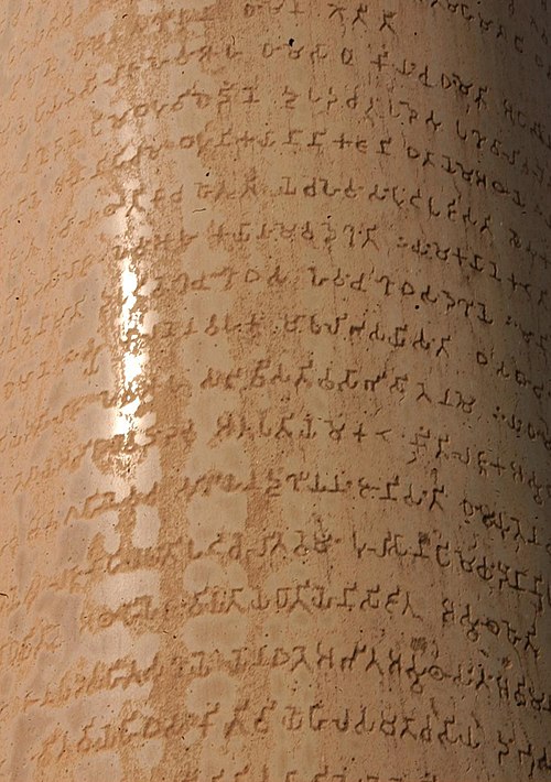
Ashoka inscribes the Edicts of Ashoka, written down using Brahmi script. The Edicts describe his Buddhist religious views and his commitment to the welfare of his subjects. Source — Wikipedia, "Timeline of Indian history" ([[3rd century BCE]]):
Ashoka Lauriya Areraj inscription By Sachin kumar tiwary - This image has been extracted from another file, CC BY-SA 3.0, https://commons.wikimedia.org/w/index.php?curid=70710778
232 BCE
Kunala
Ashoka dies and is succeeded by Kunala. Source — Wikipedia, "Timeline of Indian history" ([[3rd century BCE]]):
230 BCE
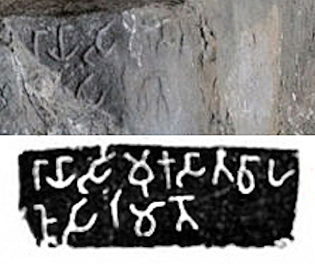
Simuka
Simuka declares independence from Mauryan rule and establishes the Satavahana Empire. Source — Wikipedia, "Timeline of Indian history" ([[3rd century BCE]]):
Simuka inscription at Naneghat Caves By Photograph by Kevin Standage Rubbing by J. Burgess (1883, d. 1892) - This image has been extracted from another file, CC BY-SA 2.0, https://commons.wikimedia.org/w/index.php?curid=82401500
200 BCE
Kuninda Kingdom
Kuninda Kingdom is established. Source — Wikipedia, "Timeline of Indian history" ([[2nd century BCE]]):
Kuninda coin. 1st-2nd century BCE. Personal photograph, 2004 (English wikipdia User PHG). By World Imaging - Self-published work by World Imaging, CC BY-SA 3.0, https://commons.wikimedia.org/w/index.php?curid=509925
185 BCE
The Mauryan Empire ends.
The Mauryan Empire ends. Source — Wikipedia, "Timeline of Indian history" ([[2nd century BCE]]):
165 BCE
Menander I
Menander I becomes the king of the Indo-Greek Kingdom. Menander is noted for having become a patron of and convert to Greco-Buddhism and he is widely regarded as the greatest of the Indo-Greek kings. Source — Wikipedia, "Timeline of Indian history" ([[2nd century BCE]]):
Menander I, portrait from coinage By CNG Coins - This image has been extracted from another file, CC BY-SA 3.0, https://commons.wikimedia.org/w/index.php?curid=115732175
100 BCE
Charaka
Birth of Charaka, ancient Indian physician who writes the Charaka Samhita, an ancient text that describes theories on human body, etiology, symptomology and therapeutics for a wide range of diseases and is based on the Agnivesha Samhitā. Source — Wikipedia, "Timeline of Indian history" ([[1st century BCE]]):
Charak Monument in Yog Peeth Campus,Father of Medicine & Surgery By Alokprasad,Balajijagadesh - Own work, CC BY-SA 3.0, https://commons.wikimedia.org/w/index.php?curid=8124213
74 BCE
Jwalapuram
Technology similar to contemporary artifacts found used by Homo sapiens in Africa found in Jwalapuram around 74,000 BCE. Source — Wikipedia, "Timeline of Indian history" (Pre-90th century BCE (BC)): )
Pre Historic Mid Krishna-Tungabhadra Valley sites are: 1. Peddamarur, 2. Chinnamarur, 3. Veerapuram(submerged), 4. Sathanikota(submerged), 5. Gondimalla, 6. Bastipadu, 7. Seripalli(Sherpally), 8. Kyathur, 9. Pragatoor, 10. Kethavaram, 11. Moorakonda, 12. Budidapadu, 13. Utakooru(submerged), 14. Chagatur(submerged), 15. Uppalapadu(submerged), 16. Krishnapuram, 17. Prathakota(submerged), 18. Gokulapadu, 19. S. Lingapuram, 20. Kudali Sangameswaram(submerged), 21. Katavanikunta, 22. Jwalapuram, 23. Billasargam, 24. Muchatla, 25. Kudaveli Note: The map is created for information and educational purposes. People using the map outside Wikipedia projects are requested to attribute it properly. By Adityamadhav83 - Own work, CC BY-SA 3.0, https://commons.wikimedia.org/w/index.php?curid=25772840
65 BCE
Pandyan
The Pandyan king sends ambassadors to the Greek and Roman lands. Source — Wikipedia, "Timeline of Indian history" ([[1st century BCE]]):
The map is sourced per Joseph E. Schwartzberg's A Historical Atlas of South Asia: please see the map online in (1978) A Historical atlas of South Asia, Chicago: University of Chicago Press, p. 38, Plate V.2 (d). Archived from the original on 5 June 2021. Retrieved on 11 May 2025. ISBN: 0226742210. . By Borders by Rawn3012 using GIMP - This image has been extracted from another file, CC BY 4.0, https://commons.wikimedia.org/w/index.php?curid=164932508
58 BCE
Vikram Samvat
Beginning of Vikram Era. Source — Wikipedia, "Timeline of Indian history" ([[1st century BCE]]):
9 BCE
Early Neolithic
Early Neolithic culture with first confirmed semi-permanent settlements appeared 11,000 years ago in the Bhimbetka rock shelters in modern Madhya Pradesh, India. Some of the Stone Age cave paintings found among the Bhimbetka rock shelters are approximately 30,000 years old. Source — Wikipedia, "Timeline of Indian history" (90th–50th century BCE):
6176 By Sarah Murray from Palo Alto, CA - 6176 Uploaded by stegop, CC BY-SA 2.0, https://commons.wikimedia.org/w/index.php?curid=12606879
4 BCE
hominid
Tools crafted by proto-humans that have been dated back two million years have been discovered in the northwestern subcontinent. The earliest archaeological site in the subcontinent is the palaeolithic hominid site in the Soan River valley. Soanian sites are found in the Sivalik region across what are now India, Pakistan, and Nepal. Some of the Bhimbetka rock shelters were inhabited by Homo erectus more than 100,000 years ago. Source — Wikipedia, "Timeline of Indian history" (Pre-90th century BCE (BC)): )
Map showing the global distribution of the great apes, including humans By Jordan Engel - https://decolonialatlas.wordpress.com/2019/06/04/distribution-of-the-great-apes-including-us/, CC BY-SA 4.0, https://commons.wikimedia.org/w/index.php?curid=93754410
1 BCE
Indo-Greek Kingdom
Fall of the Indo-Greek Kingdom. Source — Wikipedia, "Timeline of Indian history" ([[1st century BCE]]):
Coin of the Indo-Greek king Hippostratos By Classical Numismatic Group - Classical Numanistic group [1], CC BY-SA 3.0, https://commons.wikimedia.org/w/index.php?curid=1358492
35 CE
Western Satraps
Western Satraps formed. Source — Wikipedia, "Timeline of Indian history" ([[1st century]] {{anchor|1st millennium}}):
68 CE
Kushan Empire
Establishment of the Kushan Empire by Kujula Kadphises. Source — Wikipedia, "Timeline of Indian history" ([[1st century]] {{anchor|1st millennium}}):
Map of the Kushan Empire By Map created from DEMIS Mapserver, which are public domain. Koba-chan. Reference: Schwartzberg Atlas, v. , p. 145. Map g - This image has been extracted from another file, CC BY-SA 3.0, https://commons.wikimedia.org/w/index.php?curid=115482936
79 CE
Gautamiputra Satakarni
Gautamiputra Satakarni becomes Satavahana emperor and starts Shalivahana era calendar after defeating Scythian king Maues. Source — Wikipedia, "Timeline of Indian history" ([[1st century]] {{anchor|1st millennium}}):
Coinage of Gautamiputra Satakarni with Brahmi legend By Rapson, E. J. (Edward James), 1861-1937 - Plate IX, reconstructed from coins 253-258 Published in 1908, Public domain, https://commons.wikimedia.org/w/index.php?curid=81506926
100 CE
Sugar was first produced from sugarcane
Sugar was first produced from sugarcane plants in northern India sometime after the first century. Source — Wikipedia, "Timeline of Indian history" ([[1st century]] {{anchor|1st millennium}}):
113 CE
Vima Kadphises
Vima Kadphises becomes the ruler of the Kushan Empire. He was the Kushan Emperor to first introduce gold coinage, in addition to the existing silver and copper coinage. Source — Wikipedia, "Timeline of Indian history" ([[2nd century]] {{anchor|2nd millenium}}):
Double stater Vima Kadphises Guimet MG24356 (cropped) By Marie-Lan Nguyen - This image has been extracted from another file, Public domain, https://commons.wikimedia.org/w/index.php?curid=114104980
127 CE
Kanishka
Kanishka ascends the throne of the Kushan Empire, succeeding Vima Kadphises. Under his reign, the Kushan Empire reached its zenith. Source — Wikipedia, "Timeline of Indian history" ([[2nd century]] {{anchor|2nd millenium}}):
Gold coin of Kanishka. British Museum. Personal photograph 2005. By No machine-readable author provided. World Imaging assumed (based on copyright claims). - No machine-readable source provided. Own work assumed (based on copyright claims)., Public domain, https://commons.wikimedia.org/w/index.php?curid=769444
240 CE
Gupta Empire
Sri-Gupta starts the Gupta Empire in Magadha, with its capital in Pataliputra Source — Wikipedia, "Timeline of Indian history" ([[3rd century]]):
Map of the Gupta Empire Reference: Map of the Gupta Empire circa 420 CE, according to Joseph E. Schwartzberg, with contemporary polities, in (1978) A Historical atlas of South Asia, Chicago: University of Chicago Press, p. 145, map XIV.1 (j); p.25 ISBN: 0226742210. By Map created from DEMIS Mapserver, which are public domain. Koba-chan. - This image has been extracted from another file, CC BY-SA 3.0, https://commons.wikimedia.org/w/index.php?curid=115192511
250 CE
Vakataka dynasty
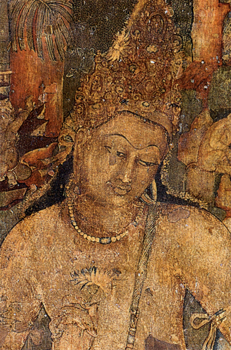
The Vakataka Dynasty in the Deccan is formed by Vindyashakti. He rules until 275. Source — Wikipedia, "Timeline of Indian history" ([[3rd century]]):
Bodhisattva Padmapani, cave 1, from Ajanta, India. By Unknown author - http://www.national-geographic.ru/ngm/200801/article_168/gallery_1394/, Public domain, https://commons.wikimedia.org/w/index.php?curid=3411328
275 CE
Pallava dynasty
The Pallava dynasty is established. Source — Wikipedia, "Timeline of Indian history" ([[3rd century]]):
Map of the Greater (Later) Pallava Dynasty By Map created from DEMIS Mapserver, which are public domain. Koba-chan. Reference: [1] Borders by Rawn3012 - This image has been extracted from another file, CC BY 4.0, https://commons.wikimedia.org/w/index.php?curid=162466499
320 CE
Chandragupta I
Chandragupta I ascends the Gupta throne. Source — Wikipedia, "Timeline of Indian history" ([[4th century]]):
A gold coin depicting Queen Kumaradevi and King Chandragupta I. Numismatist John Allan believed these coins were issued by their son Samudragupta to commemorate his parents, but the later scholars have attributed the issue of these coins to Chandragupta I. See Chandragupta I#Coinage and Samudragupta#Coinage on English Wikipedia. By Uploadalt - Own work, photographed at the British Museum, CC BY-SA 3.0, https://commons.wikimedia.org/w/index.php?curid=12232296
335 CE
Samudragupta
Samudragupta ascends the Gupta throne and expands the empire. Source — Wikipedia, "Timeline of Indian history" ([[4th century]]):
Coin of the Gupta king Samudragupta. By PHGCOM - File:SamudraguptaCoin.jpg, CC BY-SA 3.0, https://commons.wikimedia.org/w/index.php?curid=130095209
345 CE
Kadamba dynasty
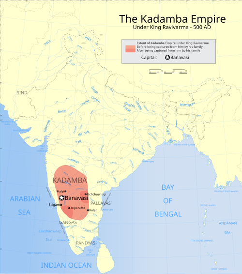
Kadamba Kingdom established by Mayurasharma, Banavasi as its capital and they were the first kingdom to use Kannada in administration. Source — Wikipedia, "Timeline of Indian history" ([[4th century]]):
Map showing the extent of the Kadamba Empire Extent before being conquered from him by his family Extent after being conquered from him by his family Extent under the feudatory of the Kadambas By w:user:Planemad - Own work International Borders: University of Texas map library - India Political map 2001 Disputed Borders: University of Texas map library - China-India Borders - Eastern Sector 1988 & Western Sector 1988 - Kashmir Region 2004 - Kashmir Maps. State and District boundaries: Census of India - 2001 Census State Maps - Survey of India Maps. Other sources: US Army Map Service, Survey of India Map Explorer, Columbia University Map specific sources: "The Kadamba Kula, A History of Ancient and Medieval Karnataka, Asian Educational Services, New Delhi, Madras, 1990 ISBN 81-206-0595-0" page 47., CC BY-SA 3.0, https://commons.wikimedia.org/w/index.php?curid=1848632
380 CE
Chandragupta II
Chandragupta II, Samudragupta's son becomes the Gupta Emperor. Source — Wikipedia, "Timeline of Indian history" ([[4th century]]):
Coin of the Gupta king Chandragupta II By PHGCOM - self-made, photographed at the British Museum, CC BY-SA 3.0, https://commons.wikimedia.org/w/index.php?curid=2237604
390 CE
Prabhavatigupta
Prabhavatigupta, a Gupta Princess who was the daughter of Chandragputa II, becomes the regent of the Vakataka dynasty after the death of her husband Rudrasena II, effectively ruling the Vakatakas until 410. Source — Wikipedia, "Timeline of Indian history" ([[4th century]]):
Bodhisattva Padmapani, cave 1, from Ajanta, India. By Unknown author - http://www.national-geographic.ru/ngm/200801/article_168/gallery_1394/, Public domain, https://commons.wikimedia.org/w/index.php?curid=3411328
413 CE
Kumaragupta I
Kumaragupta I adopted the title of Mahendraditya. Source — Wikipedia, "Timeline of Indian history" ([[5th century]]):
Coin of the Gupta king Kumaragupta By PHGCOM - self-made, photographed at the British Museum, CC BY-SA 3.0, https://commons.wikimedia.org/w/index.php?curid=2237619
455 CE
Skandagupta
Skandagupta, faced Hunas effectively. Source — Wikipedia, "Timeline of Indian history" ([[5th century]]):
Skandagupta Circa 455-480 CE. V Heavy Dinar (9.08 g, 12h). Archer type. Skandagupta, nimbate, standing left, holding arrow and bow; Garuda standard behind / The goddess Lakshmi, nimbate, seated facing on open lotus, holding diadem and lotus; tamgha to left. By CNG Coins - CNG Coins Coin from CNG coins. Used with permission (CNG coin [1]). Coin [2], CC BY-SA 3.0, https://commons.wikimedia.org/w/index.php?curid=61309571
467 CE
Huna people
Invasions by the Huna. Source — Wikipedia, "Timeline of Indian history" ([[5th century]]):
475 CE
Harishena
Harishena takes over the Vakataka Dynasty. He was a great patron of Buddhist Art. The World Heritage monument Ajanta Caves is a surviving example of his works. Source — Wikipedia, "Timeline of Indian history" ([[5th century]]):
Bodhisattva Padmapani, cave 1, from Ajanta, India. By Unknown author - http://www.national-geographic.ru/ngm/200801/article_168/gallery_1394/, Public domain, https://commons.wikimedia.org/w/index.php?curid=3411328
476 CE
Aryabhata
Birth of Aryabhata, ancient Indian mathematician and astronomer who goes on to write the Aryabhatiya, a Sanskrit astronomical treatise and the Arya-siddhanta. Source — Wikipedia, "Timeline of Indian history" ([[5th century]]):
Aryabhatta. By Cpjha13 - Own work, CC BY-SA 4.0, https://commons.wikimedia.org/w/index.php?curid=49883192
502 CE
Mihirakula
Mihirakula becomes the ruler of the Alchon Huns. He was the second and last of the Alchon Huns. He was considered to be an extremely violent and cruel ruler. He destroyed many Buddhist monasteries in his kingdom. Source — Wikipedia, "Timeline of Indian history" ([[6th century]]):
Mihirakula portrait By CNG coins. Contoured by me पाटलिपुत्र (talk) - CNG Coins Coin from CNG coins. Used with permission (CNG coin [1]). Coin [2], CC BY-SA 3.0, https://commons.wikimedia.org/w/index.php?curid=61258049
528 CE
Yashodharman
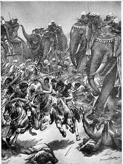
Confederation of Indian rulers Yashodharman, Narasimhagupta and Adityavardhana defeat the Huna emperor Mihirakula in the Battle of Sondani. Source — Wikipedia, "Timeline of Indian history" ([[6th century]]):
The defeat of the Ephalites, or White Huns A.D. 528. From Hutchinson's story of the nations, containing the Egyptians, the Chinese, India, the Babylonian nation, the Hittites, the Assyrians, the Phoenicians and the Carthaginians, the Phrygians, the Lydians, and other nations of Asia Minor. By Ambrose Dudley - Internet Archive identifier: hutchinsonsstory00londuoft, Public domain, https://commons.wikimedia.org/w/index.php?curid=39272154
554 CE
Gupta Empire
Collapse of Gupta Empire after the death of Vishnugupta. Source — Wikipedia, "Timeline of Indian history" ([[6th century]]):
Map of the Gupta Empire Reference: Map of the Gupta Empire circa 420 CE, according to Joseph E. Schwartzberg, with contemporary polities, in (1978) A Historical atlas of South Asia, Chicago: University of Chicago Press, p. 145, map XIV.1 (j); p.25 ISBN: 0226742210. By Map created from DEMIS Mapserver, which are public domain. Koba-chan. - This image has been extracted from another file, CC BY-SA 3.0, https://commons.wikimedia.org/w/index.php?curid=115192511
573 CE
Varāhamihira
Varāhamihira, ancient Indian astrologer, astronomer, and polymath writes the Pañcasiddhāntikā, a treatise on mathematical astronomy which summarises five earlier astronomical treatises by five authors. Source — Wikipedia, "Timeline of Indian history" ([[6th century]]):
Varāhamihira By David Martin - The White House Historical Association, Public domain, https://commons.wikimedia.org/w/index.php?curid=9390044
606 CE
Harsha
Harsha is crowned Monarch of Kannauj. Source — Wikipedia, "Timeline of Indian history" ([[7th century]]):
Harshavardhana Circa AD 606-647. AR Drachm (13mm, 2.28 g, 1h). Head left; crescent above / Fan-tailed Garuda standing facing. By CNG Coins - CNG Coins Coin from CNG coins. Used with permission (CNG coin [1]). Coin [2], CC BY-SA 3.0, https://commons.wikimedia.org/w/index.php?curid=61069595
628 CE
Brahmagupta
Ancient Indian mathematician and astronomer Brahmagupta completes the Brāhmasphuṭasiddhānta, a text on mathematical astronomy explaining the role of zero, rules for manipulating both negative and positive numbers, a method for computing square roots, methods of solving linear and quadratic equations, and rules for summing series, Brahmagupta's identity, and Brahmagupta's theorem. Brahmagupta described gravity as a force of attraction. He posited that it is the nature of the Earth to attract objects, a significant departure from the Aristotelian view of objects seeking their "natural place". Source — Wikipedia, "Timeline of Indian history" ([[7th century]]):
Description: A plus and minus symbol Source: Self-drawn using Inkscape and gedit Date: 13:21, 24 June 2006 (UTC) Author: MarianSigler (bla) Permission: ineligible By MarianSigler - Own work, Public domain, https://commons.wikimedia.org/w/index.php?curid=890780
637 CE
Badami
Badami Chalukya power at its peak. Pulakeshin II pushes north up to the Narmada and defeats the invading Harshavardhana of Kanauj. Source — Wikipedia, "Timeline of Indian history" ([[7th century]]):
Badami Cave Temples By Sanyam Bahga - Own work, CC BY-SA 3.0, https://commons.wikimedia.org/w/index.php?curid=32194045
647 CE
Harsha
Death of Harsha. Source — Wikipedia, "Timeline of Indian history" ([[7th century]]):
Harshavardhana Circa AD 606-647. AR Drachm (13mm, 2.28 g, 1h). Head left; crescent above / Fan-tailed Garuda standing facing. By CNG Coins - CNG Coins Coin from CNG coins. Used with permission (CNG coin [1]). Coin [2], CC BY-SA 3.0, https://commons.wikimedia.org/w/index.php?curid=61069595
665 CE
Brahmagupta
Ancient Indian mathematician and astronomer Brahmagupta completes the astronomical treatise Khandakhadyaka covering topics such as the longitudes of the planets, diurnal rotation, lunar and solar eclipses, risings and settings, the moon's crescent and conjunctions of the planets. Source — Wikipedia, "Timeline of Indian history" ([[7th century]]):
700 CE
Qissa-i Sanjan
According to the Qissa-i Sanjan, the immigrants Parsi are granted permission to stay by the local ruler Jadi Rana. Source — Wikipedia, "Timeline of Indian history" ([[8th century]]):
Author: Kevin McCormick By The original uploader was Ploxhoi at English Wikipedia. - Transferred from en.wikipedia to Commons., CC BY-SA 3.0, https://commons.wikimedia.org/w/index.php?curid=3555101
711 CE
Umayyad Caliphate
Arab commander of the Umayyad Caliphate, Muhammad bin Qasim defeats Raja Dahir, king of Sindh Region in modern-day Pakistan. Source — Wikipedia, "Timeline of Indian history" ([[8th century]]):
The Umayyad Caliphate at its greatest extent, in 720, under Caliph Umar II. By Ergovius - Own work, CC BY-SA 4.0, https://commons.wikimedia.org/w/index.php?curid=101110977
728 CE
Narasimhavarman II
Narasimhavarman II of the Pallava dynasty constructs the Shore Temple of Mamallapuram. Source — Wikipedia, "Timeline of Indian history" ([[8th century]]):
Map of the Greater (Later) Pallava Dynasty By Map created from DEMIS Mapserver, which are public domain. Koba-chan. Reference: [1] Borders by Rawn3012 - This image has been extracted from another file, CC BY 4.0, https://commons.wikimedia.org/w/index.php?curid=162466499
736 CE
Delhi
Delhi is re-established by Bilan Deo Tomar also known as Anangpal Tomar. Source — Wikipedia, "Timeline of Indian history" ([[8th century]]):
Jama Masjid mosque, Dehli, India. By Marcin Białek - Own work, CC BY-SA 4.0, https://commons.wikimedia.org/w/index.php?curid=12799013
738 CE
Nagabhata I
Confederacy of Indian kings consisting of Nagabhata I of Gurjara-Pratihara dynasty and Bappa Rawal, ruler of Mewar defeat Arab Umayyad Caliphate invasion attempts in the Battle of Rajasthan (738 CE) Source — Wikipedia, "Timeline of Indian history" ([[8th century]]):
Coin of Bhoja-I, Pratihara Dynasty By User:Ancientcoinsofindia1, English Wikipedia - Coins of India website ( Uploaded By owner Amol N. Bankar , ancientcoinsofindia@yahoo.co.in ), CC BY 2.5, https://commons.wikimedia.org/w/index.php?curid=129665590
739 CE
Chalukyas of Navasarika
Avanijanashraya Pulakeshin of the Chalukyas of Navasarika kingdom defeats an invasion attempt by the Arab Umayyad Caliphate. Source — Wikipedia, "Timeline of Indian history" ([[8th century]]):
753 CE
Saindhava
Saindhava naval fleet defeats Arab naval fleet sent by the Arab governor of Sindh. Source — Wikipedia, "Timeline of Indian history" ([[8th century]]):
Un drachme des dynasties Saindhava ou Chalukya datant d'environ 800-950 en argent. A l'avers, un buste tourné à droite de style indo-sassanian avec des points. Au revers, un feu stylisé. Dimension : 14 mm Poids 4 g. Référence : Mitchiner NIS 419 La dynastie Chalukya a régné sur une partie de l'Inde du Sud et centrale. La dynastie Saindhava a régné sur le Saurashtra. Coins of rulers of India (Chalukyas of Gujarat) A drachma of the Saindhava or Chalukya dynasties dating from about 800-950 in silver. On the obverse, a bust turned right of indo-sassanian style with points. On the reverse, a stylized fire. Dimension: 14 mm Weight 4 g. Reference: Mitchiner NIS 419 The Chalukya dynasty ruled over part of South and Central India. The Saindhava dynasty ruled over Saurashtra. By Jean-Michel Moullec from Vern sur Seiche (35, Bretagne), France - I56_Saindhavas_drachme_1, CC BY 2.0, https://commons.wikimedia.org/w/index.php?curid=57687902
753 CE
Rashtrakuta
Establishment of Rashtrakuta Kingdom of Manyakhet by Dantidurga by defeating Chalukyas of Badami Source — Wikipedia, "Timeline of Indian history" ([[8th century]]):
The map is sourced per John Keay's India: A History: please see the map from Google Books in John Keay (2000) India: A History, Grove Publication, p. 198 ISBN: 0802137970. By Borders by Rawn3012 using GIMP - This image has been extracted from another file, CC BY 4.0, https://commons.wikimedia.org/w/index.php?curid=163681076
776 CE
Saindhava
Saindhava naval fleet under Agguka I defeats second Arab naval expedition. Source — Wikipedia, "Timeline of Indian history" ([[8th century]]):
Un drachme des dynasties Saindhava ou Chalukya datant d'environ 800-950 en argent. A l'avers, un buste tourné à droite de style indo-sassanian avec des points. Au revers, un feu stylisé. Dimension : 14 mm Poids 4 g. Référence : Mitchiner NIS 419 La dynastie Chalukya a régné sur une partie de l'Inde du Sud et centrale. La dynastie Saindhava a régné sur le Saurashtra. Coins of rulers of India (Chalukyas of Gujarat) A drachma of the Saindhava or Chalukya dynasties dating from about 800-950 in silver. On the obverse, a bust turned right of indo-sassanian style with points. On the reverse, a stylized fire. Dimension: 14 mm Weight 4 g. Reference: Mitchiner NIS 419 The Chalukya dynasty ruled over part of South and Central India. The Saindhava dynasty ruled over Saurashtra. By Jean-Michel Moullec from Vern sur Seiche (35, Bretagne), France - I56_Saindhavas_drachme_1, CC BY 2.0, https://commons.wikimedia.org/w/index.php?curid=57687902
788 CE
Adi Shankara
Birth of Adi Shankara. Source — Wikipedia, "Timeline of Indian history" ([[8th century]]):
Adi Shankara with disciples. By Raja Ravi Varma - Google Arts & Culture — adi-shankaracharya/WgFvX3x6i0ckfQ, Public domain, https://commons.wikimedia.org/w/index.php?curid=10306665
800 CE
Vikramashila
Vikramashila University is established by the Pala emperor Dharmapala in present-day Bhagalpur district in Bihar, in early 9th century Source — Wikipedia, "Timeline of Indian history" ([[9th century]]):
This is a photo of ASI monument number By Prataparya - Own work, CC BY-SA 3.0, https://commons.wikimedia.org/w/index.php?curid=21817184
814 CE
Amoghavarsha I
Nripatunga Amoghavarsha I becomes Rashtrakuta emperor. Kannada literature flourishes. Source — Wikipedia, "Timeline of Indian history" ([[9th century]]):
Kumsi is a village in Soraba Taluq of Shimoga district in the Karnataka state, India. The inscription was found at the Virabhadra temple. Ref: List of inscriptions in Chronological order (pages 1-8); Part II, Text of inscriptions in Roman characters, inscription Sb. 85, page 24; Translation of inscriptions, Sb. 85 on page 13 By B. Lewis Rice (Benjamin Lewis Rice, 1837-1927) - Epigraphia Carnatica: Inscriptions in the Shimoga District, Volume VIII, Public domain, https://commons.wikimedia.org/w/index.php?curid=37297564
836 CE
Mihira Bhoja
Mihira Bhoja, regarded as the greatest ruler of the Gujara-Pratihara dynasty, he reorganized the empire to its peak. Source — Wikipedia, "Timeline of Indian history" ([[9th century]]):
Coin of Bhoja-I, Pratihara Dynasty By User:Ancientcoinsofindia1, English Wikipedia - Coins of India website ( Uploaded By owner Amol N. Bankar , ancientcoinsofindia@yahoo.co.in ), CC BY 2.5, https://commons.wikimedia.org/w/index.php?curid=129665590
935 CE
Chandrapur University
Chandrapur University established in 935 CE by Srichandra, a ruler of the Chandra dynasty. Source — Wikipedia, "Timeline of Indian history" ([[10th century]]):
Map of "Bengal" from Pope, G. U. (1880) Text-book of Indian History: Geographical Notes, Genealogical Tables, Examination Questions, London: W. H. Allen & Co. Pp. vii, 574, 16 maps . Scanned from personal copy and uploaded by Fowler&fowler By W. H. Allen and Co. - Pope, G. U. (1880) Text-book of Indian History: Geographical Notes, Genealogical Tables, Examination Questions, London: W. H. Allen & Co. Pp. vii, 574, 16 maps, Public domain, https://commons.wikimedia.org/w/index.php?curid=143827170
985 CE
Rajaraja Chola
Rajaraja Chola ascends to the throne of Chola empire. He expands the empire to Sri Lanka and to the north to include Kalinga kingdom. Source — Wikipedia, "Timeline of Indian history" ([[10th century]]):
Wall paintings By Junykwilfred - Own work, Public domain, https://commons.wikimedia.org/w/index.php?curid=30828054
993 CE
Rajaraja Chola
Rajaraja Chola invades Sri Lanka, capturing the northern half. Source — Wikipedia, "Timeline of Indian history" ([[10th century]]):
Wall paintings By Junykwilfred - Own work, Public domain, https://commons.wikimedia.org/w/index.php?curid=30828054
1000 CE
Mahmud of Ghazni
Invasion of Mahmud of Ghazni begins (1000–1025 CE). Source — Wikipedia, "Timeline of Indian history" ([[11th century]] {{anchor|2nd millennium}}):
Mahmud of Ghazni, Ghaznavid ruler, conquering Qasdar (modern Khuzdar) in India, miniature from the Jamiʿ al-Tawarikh of Rashid al-Din Il-Khanid Tabriz Ms Or 20 f.108v By 1314-15 - [1] Mahmud ibn Sebuktegin, Ghaznavid ruler, conquering Qasdar (modern Khuzdar) in India, miniature from the Jamiʿ al-Tawarikh of Rashid al-Din Il-Khanid Tabriz Ms Or 20 f.108v, Public domain, https://commons.wikimedia.org/w/index.php?curid=181049706
1003 CE
Brihadisvara Temple
The Brihadisvara Temple is built by Raja Raja Chola I. Source — Wikipedia, "Timeline of Indian history" ([[11th century]] {{anchor|2nd millennium}}):
Brihadisvara Temple during Maha Shivaratri By Original: Rainer Halama Derivative work: UnpetitproleX - This file was derived from: Brihadisvara Temple during Maha Shivaratri-WUS03611.jpg, CC BY-SA 4.0, https://commons.wikimedia.org/w/index.php?curid=176922407
1014 CE
Mahmud of Ghazni
Mahmud Ghazni defeats the Hindu Shahi king Trilochanapala and annexes Punjab. Source — Wikipedia, "Timeline of Indian history" ([[11th century]] {{anchor|2nd millennium}}):
Mahmud of Ghazni, Ghaznavid ruler, conquering Qasdar (modern Khuzdar) in India, miniature from the Jamiʿ al-Tawarikh of Rashid al-Din Il-Khanid Tabriz Ms Or 20 f.108v By 1314-15 - [1] Mahmud ibn Sebuktegin, Ghaznavid ruler, conquering Qasdar (modern Khuzdar) in India, miniature from the Jamiʿ al-Tawarikh of Rashid al-Din Il-Khanid Tabriz Ms Or 20 f.108v, Public domain, https://commons.wikimedia.org/w/index.php?curid=181049706
1014 CE
Lakshadweep
Rajaraja Chola adds the Lakshadweep and Maldives islands to the Chola empire. Source — Wikipedia, "Timeline of Indian history" ([[11th century]] {{anchor|2nd millennium}}):
Kadmat Island, Lakshadweep. The water here is very clear and you can see the bottom. This is a lovely place but unfortunately, tourists are not allowed beyond a particular point (I guess due to some security reasons). By Manvendra Bhangui from Chennai, India - Kadmat Island, CC BY-SA 2.0, https://commons.wikimedia.org/w/index.php?curid=7013842
Apr 26, 1017 CE
Ramanuja
Ramanuja is born at Sriperumbudur, Tamil Nadu. Source — Wikipedia, "Timeline of Indian history" ([[11th century]] {{anchor|2nd millennium}}):
1017 CE
al-Biruni
al-Biruni travelled to the Indian subcontinent. Source — Wikipedia, "Timeline of Indian history" ([[11th century]] {{anchor|2nd millennium}}):
1021 CE
Mahmud of Ghazni again attempts to
Mahmud of Ghazni again attempts to invade Kashmir, but is defeated by Samgrāmarāja. Source — Wikipedia, "Timeline of Indian history" ([[11th century]] {{anchor|2nd millennium}}):
Apr 30, 1025 CE
Mahmud of Ghazni
Last invasion of Mahmud Ghazni, sacked and destroyed temple of Somnath. Source — Wikipedia, "Timeline of Indian history" ([[11th century]] {{anchor|2nd millennium}}):
Mahmud of Ghazni, Ghaznavid ruler, conquering Qasdar (modern Khuzdar) in India, miniature from the Jamiʿ al-Tawarikh of Rashid al-Din Il-Khanid Tabriz Ms Or 20 f.108v By 1314-15 - [1] Mahmud ibn Sebuktegin, Ghaznavid ruler, conquering Qasdar (modern Khuzdar) in India, miniature from the Jamiʿ al-Tawarikh of Rashid al-Din Il-Khanid Tabriz Ms Or 20 f.108v, Public domain, https://commons.wikimedia.org/w/index.php?curid=181049706
1027 CE
Sun Temple, Modhera
The Sun Temple of Modhera is completed by Bhima I of the Chaulukya dynasty Source — Wikipedia, "Timeline of Indian history" ([[11th century]] {{anchor|2nd millennium}}):
Apr 30, 1030 CE
Death of Mahmud of Ghazni.
Death of Mahmud of Ghazni. Source — Wikipedia, "Timeline of Indian history" ([[11th century]] {{anchor|2nd millennium}}):
Jun 15, 1033 CE
Suhaldev
Suhaldev, king of Shravasti defeats and kills Ghazi Saiyyad Salar Masud, nephew of Mahmud of Ghazni. Source — Wikipedia, "Timeline of Indian history" ([[11th century]] {{anchor|2nd millennium}}):
Mahmud of Ghazni, Ghaznavid ruler, conquering Qasdar (modern Khuzdar) in India, miniature from the Jamiʿ al-Tawarikh of Rashid al-Din Il-Khanid Tabriz Ms Or 20 f.108v By 1314-15 - [1] Mahmud ibn Sebuktegin, Ghaznavid ruler, conquering Qasdar (modern Khuzdar) in India, miniature from the Jamiʿ al-Tawarikh of Rashid al-Din Il-Khanid Tabriz Ms Or 20 f.108v, Public domain, https://commons.wikimedia.org/w/index.php?curid=181049706
1035 CE
Brihadisvara Temple, Gangaikonda Cholapuram
The Brihadisvara Temple, Gangaikonda Cholapuram is built by Rajendra Chola I. Source — Wikipedia, "Timeline of Indian history" ([[11th century]] {{anchor|2nd millennium}}):
1058 CE
Soomra dynasty
Soomra dynasty ends the Arab domination and establishes its own rule over Sindh. Source — Wikipedia, "Timeline of Indian history" ([[11th century]] {{anchor|2nd millennium}}):
1120 CE
Kalyani Chalukyas
Kalyani Chalukyas power at its peak. Vikramaditya VI ushers in Vikrama Chalukya era. Source — Wikipedia, "Timeline of Indian history" ([[12th century]]):
1121 CE
Ajayaraja II
Ajayaraja II, of the Chahamanas of Shakambhari dynasty repulse Ghaznavid invasions. Source — Wikipedia, "Timeline of Indian history" ([[12th century]]):
1134 CE
Basaveshwara
Life of Basaveshwara, philosopher and social reformer (to 1196). Source — Wikipedia, "Timeline of Indian history" ([[12th century]]):
Sep 30, 1149 CE
Chand Baradai
Birth of the Great poet and writer of India Chand Baradai in Lahore. Source — Wikipedia, "Timeline of Indian history" ([[12th century]]):
1150 CE
Bhāskara II
Bhāskara II, mathematician and astronomer writes the Siddhānta Shiromani, consisting of three books Līlāvatī on arithmetic and measurement, Bijaganita on algebra and Gaṇitādhyāya and Golādhyāya on astronomy. Source — Wikipedia, "Timeline of Indian history" ([[12th century]]):
1157 CE
Kalachuris of Kalyani
The Kalachuris of Kalyani under Bijjala II capture Kalyani Source — Wikipedia, "Timeline of Indian history" ([[12th century]]):
1175 CE
Muhammad of Ghor
Muhammad of Ghor invades India. Source — Wikipedia, "Timeline of Indian history" ([[12th century]]):
1178 CE
Chaulukya
Forces of the Chaulukya king Mularaja II led by his regent mother Naiki Devi defeat Ghurid invaders led by Muhammad of Ghor who escapes back to Ghazni, in the Battle of Kasahrada. Source — Wikipedia, "Timeline of Indian history" ([[12th century]]):
1191 CE
First Battle of Tarain
First Battle of Tarain between Mohammed Ghori and Prithviraj III. Ghori is defeated by Prithivi Raj Chauhan III. Source — Wikipedia, "Timeline of Indian history" ([[12th century]]):
1192 CE
Second Battle of Tarain
Second Battle of Tarain fought between Muhammed Ghori and Prithviraj Chauhan III. Prithviraj Chauhan III is defeated by Mohammed Ghori. Source — Wikipedia, "Timeline of Indian history" ([[12th century]]):
1193 CE
Muhammad bin Bakhtiyar Khalji
Muslim general Muhammad bin Bakhtiyar Khalji destroys the ancient university of Vikramashila. Source — Wikipedia, "Timeline of Indian history" ([[12th century]]):
1194 CE
Battle of Chandawar
Battle of Chandawar fought between Muhammad of Ghor and Jaichand of Kannauj. Ghori defeated Jayachandra and killed him. Source — Wikipedia, "Timeline of Indian history" ([[12th century]]):
Mar 15, 1206 CE
Khokhar
Khokhars killed Muhammad Ghori during a raid on his camp on the Jhelum River, marking the end of 14 years of Ghurid rule over northern India (1192–1206). Source — Wikipedia, "Timeline of Indian history" ([[13th century]]):
Jun 25, 1206 CE
Qutb ud-Din Aibak
Qutb ud-Din Aibak establishes slave dynasty (Mamluk) later to be known as Delhi Sultanate, beginning 320 years rule over India (1206–1526). Source — Wikipedia, "Timeline of Indian history" ([[13th century]]):
1206 CE
Raja Prithu
Raja Prithu defeats Muhammad Bakhtiyar Khalji, destroying his army of 12,000 with only about 100 survivors. Source — Wikipedia, "Timeline of Indian history" ([[13th century]]):
1210 CE
Iltutmish
Shams ud-Din Iltutmish, the third ruler of the Delhi Sultanate, belonging to the Mamluk dynasty (slave dynasty), introduced IQTA (tax, revenue) system. Died in 1236. Source — Wikipedia, "Timeline of Indian history" ([[13th century]]):
1210 CE
Qutb ud-Din Aibak
Qutb ud-Din Aibak dies while playing polo. Source — Wikipedia, "Timeline of Indian history" ([[13th century]]):
1211 CE
Anangabhima Deva III
Anangabhima Deva III of the Eastern Ganga dynasty in present-day Odisha defeats invasions by Ghiyāth ad-Dīn ʿIwaz Khalji the ruler of Bengal. Source — Wikipedia, "Timeline of Indian history" ([[13th century]]):
1221 CE
Genghis Khan
Genghis Khan invades Punjab in pursuit of the fleeing Khwarezm Shah Jalal al-Din Mangburni and defeats him in the Battle of the Indus. Source — Wikipedia, "Timeline of Indian history" ([[13th century]]):
1226 CE
Raja Prithu
Raja Prithu repulses invading forces of Ghiyas ud din Balban the ninth sultan of the Mamluk dynasty of Delhi, in present-day Assam Source — Wikipedia, "Timeline of Indian history" ([[13th century]]):
1229 CE
Sandhya
Sandhya (ruler of Kamarupa) in present-day Assam drives Muslims out of his territory and captures territory till Karatoya river. Thereafter, to avenge previous defeats, he invades the western border of Gaur (Lakhnauti) and annexes regions across the Karatoya into his kingdom. Source — Wikipedia, "Timeline of Indian history" ([[13th century]]):
Nov 10, 1236 CE
Razia Sultana
Rule of Razia Sultana; the daughter of Iltutmish. Source — Wikipedia, "Timeline of Indian history" ([[13th century]]):
1236 CE
Narasingha Deva I
Narasingha Deva I ruler of the Eastern Ganga dynasty in present-day Odisha launches attacks against the Turko-Afghan rulers of Mamluk dynasty in Bengal that had captured Bihar and Bengal and not only repulses their attacks, but pushes them as far back as Padma River in current-day Bangladesh. Source — Wikipedia, "Timeline of Indian history" ([[13th century]]):
Oct 1, 1238 CE
Madhvacharya
Sri Madhwacharya born in Pajaka near Udupi, Karnataka Source — Wikipedia, "Timeline of Indian history" ([[13th century]]):
Oct 14, 1240 CE
Razia Sultana
Murder of Razia Sultan by Turkish nobles (Chalisa). Source — Wikipedia, "Timeline of Indian history" ([[13th century]]):
1243 CE
Narasingha Deva I
Narasingha Deva I ruler of the Eastern Ganga dynasty defeats Tughral Tughan Khan of the Mamluk Sultanate of Delhi in the Battle of Katasin and annexes several districts of Bengal into his empire. Source — Wikipedia, "Timeline of Indian history" ([[13th century]]):
1246 CE
Nasiruddin Mahmud
Rule of Nasiruddin Mahmud with support of Balban (Wazir and powerful member of Chalisa). Chalisa- a council of 40 members. Source — Wikipedia, "Timeline of Indian history" ([[13th century]]):
1250 CE
Konark Sun Temple
The Konark Sun Temple is completed, built by Narasingha Deva I. Source — Wikipedia, "Timeline of Indian history" ([[13th century]]):
1257 CE
Malik Ikhtiyaruddin Yuzbak
The Kamrup kingdom, led by its ruler Sandhya defeats and executes Malik Ikhtiyaruddin Yuzbak, the Mamluk Governor of Bengal. His domains are split between the Kamrup kingdom and Narasimhadeva I of the Eastern Ganga Empire. Source — Wikipedia, "Timeline of Indian history" ([[13th century]]):
1266 CE
Rule of Balban; Chalisa wiped out.
Rule of Balban; Chalisa wiped out. Source — Wikipedia, "Timeline of Indian history" ([[13th century]]):
1267 CE
Mahanubhava
The Mahanubhava philosophy established by Chakradhar Swami. Source — Wikipedia, "Timeline of Indian history" ([[13th century]]):
1275 CE
Dnyaneshwar
Birth of saint Dnyaneshwar. Source — Wikipedia, "Timeline of Indian history" ([[13th century]]):
1290 CE
Khalji dynasty
Jalal-ud-din Khilji founds the Khiliji Dynasty. Source — Wikipedia, "Timeline of Indian history" ([[13th century]]):
1290 CE
Muiz ud din Qaiqabad
Murder of Muiz ud din Qaiqabad by Jalaluddin Firuz Khalji, an army commander. Source — Wikipedia, "Timeline of Indian history" ([[13th century]]):
1309 CE
Kakatiya dynasty
Alauddin Khalji sends Malik Kafur to South. Malik Kafur Lays siege on the Kakatiya dynasty Capital Warangal and Extracts Tribute. The diamond Kohinoor was among the loot collected. Source — Wikipedia, "Timeline of Indian history" ([[14th century]]):
1310 CE
Ala-ud-din Khilji
Ala-ud-din Khilji's army under Malik Kafur occupies Devagiri ending the Seuna Yadava Kingdom Source — Wikipedia, "Timeline of Indian history" ([[14th century]]):
1311 CE
Malik Kafur attacks the Hoyasalas. In
Malik Kafur attacks the Hoyasalas. In the aftermath of the destruction Hoyasalas abandon the old capital Halebidu. He later attacks Madurai. The attacks on Warangal, Halebidu and Madurai is accompanied by wide scale killing, destruction of temples and repatriation of wealth back to Delhi. Source — Wikipedia, "Timeline of Indian history" ([[14th century]]):
Nov 9, 1323 CE
Muhammad bin Tughluq
Ulugh Khan (Muhammad bin Tughluq) defeats Prataparudra II ending the Kakatiya dynasty. Source — Wikipedia, "Timeline of Indian history" ([[14th century]]):
1333 CE
Hindu
Prithvi Chand II of the Hindu Katoch kingdom of Kangra defeats the army of Muhammad bin Tughluq who loses nearly all his 10,000 soldiers and is forced to retreat. Source — Wikipedia, "Timeline of Indian history" ([[14th century]]):
1334 CE
Musunuri Nayakas
Musunuri Kapaya Nayaka with assistance from the Hoysala ruler Veera Ballala III leads a rebellion against the Tughluq rule of Delhi Sultanate, driving it out of Warangal region in present-day Telangana. Source — Wikipedia, "Timeline of Indian history" ([[14th century]]):
Apr 18, 1336 CE
Vijayanagara Empire
Vijayanagara Empire established by Harihara I and his brother Bukka Raya I. Source — Wikipedia, "Timeline of Indian history" ([[14th century]]):
1340 CE
Madhava of Sangamagrama
Birth of great mathematician Madhava of Sangamagrama who goes on to found the Kerala school of astronomy and mathematics and write the Venvaroha, which describes the methods for the computation of the true positions of the Moon at intervals of about half an hour for various days in an anomalistic cycle. Source — Wikipedia, "Timeline of Indian history" ([[14th century]]):
1343 CE
Veera Ballala III
Veera Ballala III captured and killed in the Battle of Kannanur. Source — Wikipedia, "Timeline of Indian history" ([[14th century]]):
1347 CE
Hasan Gangu
Governor Hasan Gangu revolts against Muhammad bin Tughluq founding the Bahmani Sultanate. Source — Wikipedia, "Timeline of Indian history" ([[14th century]]):
1351 CE
Samma Dynasty
Samma Dynasty assumes rule over Sindh. Source — Wikipedia, "Timeline of Indian history" ([[14th century]]):
1370 CE
Bukka
Bukka, the Vijayanagara ruler and his son Kumara Kamapna capture the entire Tamil speaking parts. Source — Wikipedia, "Timeline of Indian history" ([[14th century]]):
1398 CE
Sack of Delhi
Sack of Delhi is committed by Timur's invasion. He plunders cities such as Lahore, Tulamba, Multan, and Bhatner. Source — Wikipedia, "Timeline of Indian history" ([[14th century]]):
1401 CE
Dilawar Khan
Dilawar Khan establishes the Malwa Sultanate in present-day northern India. Source — Wikipedia, "Timeline of Indian history" ([[15th century]]):
1407 CE
Muzaffar Shah I
Zafar Khan: governor of Gujarat, declares himself as Sultan Muzaffar Shah founding the Gujarat Sultanate/Muzaffarid dynasty. Source — Wikipedia, "Timeline of Indian history" ([[15th century]]):
1414 CE
Khizr Khan
Khizr Khan, deputized by Timur to be the governor of Multan takes over Delhi founding the Sayyid dynasty Source — Wikipedia, "Timeline of Indian history" ([[15th century]]):
1424 CE
Deva Raya II
Deva Raya II succeeded his father Veera Vijaya Bukka Raya as monarch of the Vijayanagara Empire Source — Wikipedia, "Timeline of Indian history" ([[15th century]]):
1437 CE
Rana Kumbha
Rana Kumbha of Mewar and Rao Ranmal Rathore of Marwar defeat and take prisoner Mahmud Khalji, Sultan of the Malwa Sultanate in the Battle of Sarangpur Source — Wikipedia, "Timeline of Indian history" ([[15th century]]):
City Palace by Lake Pichola, Udaipur By Jakub Hałun - Own work, CC BY-SA 4.0, https://commons.wikimedia.org/w/index.php?curid=87780276
1442 CE
Battle of Mandalgarh and Banas
Rana Kumbha of Mewar defeats Mahmud Khalji in the Battle of Mandalgarh Source — Wikipedia, "Timeline of Indian history" ([[15th century]]):
1443 CE
Abdur Razzaq
Abdur Razzaq visits India. Source — Wikipedia, "Timeline of Indian history" ([[15th century]]):
1446 CE
Battle of Mandalgarh and Banas
Rana Kumbha of Mewar defeats Mahmud Khalji in the Battle of Banas Source — Wikipedia, "Timeline of Indian history" ([[15th century]]):
Sep 26, 1449 CE
Sankardev
Sankardev, founder of Ekasarana Dharma was born in Nagaon, Assam. Source — Wikipedia, "Timeline of Indian history" ([[15th century]]):
1450 CE
Ravidas
Shri Guru Ravidas Ji was born in 1450 in Varanasi. He was an Indian mystic poet-sant of the Bhakti movement during the 15th to 16th century CE. Venerated as a guru in the region of Punjab, Uttar Pradesh, Rajasthan, Maharashtra and Madhya Pradesh, the devotional songs of Ravidas have had a lasting impact upon the bhakti movement. Source — Wikipedia, "Timeline of Indian history" ([[15th century]]):
Apr 19, 1451 CE
Bahlul Khan Lodhi
Bahlul Khan Lodhi ascends the throne of the Delhi sultanate starting the Lodhi dynasty Source — Wikipedia, "Timeline of Indian history" ([[15th century]]):
1456 CE
Rana Kumbha
Rana Kumbha of Mewar defeats the combined armies of Shams Khan (sultan of Nagaur) and Qutbuddin Ahmad Shah II (Sultan of Gujarat) in the Battle of Nagaur and captures Nagaur, Kasili, Khandela and Shakambhari. Nagaur Sultanate ceases to exist. Source — Wikipedia, "Timeline of Indian history" ([[15th century]]):
Apr 15, 1469 CE
Guru Nanak
Guru Nanak, the founder of Sikhism, is born. Source — Wikipedia, "Timeline of Indian history" ([[15th century]]):
Feb 14, 1483 CE
Babur
Birth of Babur in Andijan, Fergana Valley in Central Asia. Source — Wikipedia, "Timeline of Indian history" ([[15th century]]):
1485 CE
Saluva Narasimha Deva Raya
Saluva Narasimha Deva Raya drives out Praudha Raya ending the Sangama Dynasty. Source — Wikipedia, "Timeline of Indian history" ([[15th century]]):
1486 CE
Chaitanya Mahaprabhu
Advent of Chaitanya Mahaprabhu, founder of Gaudiya Vaishnavism and leader of the world's first civil disobedience movement, in Navadwip, West Bengal. Source — Wikipedia, "Timeline of Indian history" ([[15th century]]):
1490 CE
Adil Shahi
Ahmadnagar declares independence, followed by Bijapur and Berar in the same year thus breaking up the Bahmani Sultanate. Source — Wikipedia, "Timeline of Indian history" ([[15th century]]):
Mar 30, 1492 CE
Satal Rathore of Marwar
Satal Rathore of Marwar kills Afghan warlord Gudhla Khan in the Battle of Peepar, to rescue 140 girls abducted by the Afghans. He later succumbs to injuries sustained in the battle. Source — Wikipedia, "Timeline of Indian history" ([[15th century]]):
May 20, 1498 CE
Vasco de Gama
Vasco de Gama was the first portage's sailor first voyage from Portugal to India and back (in 1499). Source — Wikipedia, "Timeline of Indian history" ([[15th century]]):
1503 CE
Kingdom of Cochin
Kingdom of Cochin is taken over by the Portuguese creating the first European settlement in India. Source — Wikipedia, "Timeline of Indian history" ([[16th century]]):
Feb 3, 1508 CE
Battle of Chaul
The Christian-Islamic power struggle in Europe and the Middle East. Spills over into the Indian Ocean as Battle of Chaul during the Portuguese-Mamluk War. Source — Wikipedia, "Timeline of Indian history" ([[16th century]]):
Feb 3, 1509 CE
Battle of Diu
Battle of Diu marks the beginning of the dominance of the Europeans in the Asian naval theater. Source — Wikipedia, "Timeline of Indian history" ([[16th century]]):
1518 CE
Udaipur State
Kingdom of Mewar under Rana Sanga defeats Lodi Empire under Ibrahim Lodhi in the Battle of Khatoli, gains control over north eastern Rajasthan. Source — Wikipedia, "Timeline of Indian history" ([[16th century]]):
1519 CE
Malwa Sultanate
Kingdom of Mewar under Rana Sanga defeats the Malwa Sultanate and the Gujarat Sultanate in the Battle of Gagron, obtains control of Malwa. Source — Wikipedia, "Timeline of Indian history" ([[16th century]]):
1520 CE
Vijayanagara Empire
Vijayanagara Empire under Krishnadevaraya defeats the Sultanate of Bijapur in the Battle of Raichur. Source — Wikipedia, "Timeline of Indian history" ([[16th century]]):
1522 CE
Coromandel Coast
The Portuguese land on the Coromandel Coast. Source — Wikipedia, "Timeline of Indian history" ([[16th century]]):
Apr 21, 1526 CE
Ibrahim Lodi
Sultan Ibrahim Lodi, of the Delhi Sultanate, angers local nobles, who respond by inviting Babur, the Mughal ruler of Kabul, to invade Delhi and Agra. The local population, plus the possession of artillery, assists Babur in killing the Sultan (whose soldiers desert him) at the First Battle of Panipat. Marks the beginning of Mughal Empire. Source — Wikipedia, "Timeline of Indian history" ([[16th century]]):
Jama Masjid mosque, Dehli, India. By Marcin Białek - Own work, CC BY-SA 4.0, https://commons.wikimedia.org/w/index.php?curid=12799013
Mar 17, 1527 CE
Battle of Khanwa
Babur defeats Rana Sanga of Mewar in the Battle of Khanwa. Source — Wikipedia, "Timeline of Indian history" ([[16th century]]):
1530 CE
Jyeṣṭhadeva
Astronomer-mathematician Jyeṣṭhadeva of the Kerala school of astronomy and mathematics writes the Yuktibhāṣā, a major treatise on mathematics and astronomy in Malayalam. Source — Wikipedia, "Timeline of Indian history" ([[16th century]]):
1532 CE
Ahom kingdom
Ahoms under king Suhungmung defeat Turbak Khan of the Bengal Sultanate in Battle of Hatbor. Source — Wikipedia, "Timeline of Indian history" ([[16th century]]):
1539 CE
Battle of Chausa
Battle of Chausa fought between Humayun and Sher Shah Suri in which Humayun is defeated. Source — Wikipedia, "Timeline of Indian history" ([[16th century]]):
Sep 18, 1540 CE
Kannauj
Battle of Kannauj fought between Humayun and Sher Shah Suri and Humayun was completely defeated. Humayun lost the Mughal empire to Afghans (Suri Dynasty), and passed 12 years in exile. Source — Wikipedia, "Timeline of Indian history" ([[16th century]]):
Oct 15, 1542 CE
Akbar
Akbar is born at Umerkot. Source — Wikipedia, "Timeline of Indian history" ([[16th century]]):
May 22, 1545 CE
Sher Shah Suri
Death of Sher Shah Suri and succeeded by Islam Shah Suri. Source — Wikipedia, "Timeline of Indian history" ([[16th century]]):
Mar 26, 1552 CE
Guru Amar Das
Guru Amar Das becomes third Guru of Sikhs. Source — Wikipedia, "Timeline of Indian history" ([[16th century]]):
Nov 22, 1554 CE
Islam Shah Suri
Islam Shah Suri dies. Source — Wikipedia, "Timeline of Indian history" ([[16th century]]):
May 22, 1555 CE
Humayun regained the throne of Delhi
Humayun regained the throne of Delhi from the hands of weak successors of Sher Shah after Battle of Sirhind. Source — Wikipedia, "Timeline of Indian history" ([[16th century]]):
Jan 27, 1556 CE
Akbar
Humayun dies, and is succeeded by his son Akbar. Source — Wikipedia, "Timeline of Indian history" ([[16th century]]):
Jan 26, 1565 CE
Battle of Talikota
Battle of Talikota results in the rout of Vijayanagara Empire. Source — Wikipedia, "Timeline of Indian history" ([[16th century]]):
1568 CE
Paradesi Synagogue
Paradesi Synagogue, the first Jewish synagogue in India constructed by the Paradesi Jews. Source — Wikipedia, "Timeline of Indian history" ([[16th century]]):
1572 CE
Gujarat
Akbar annexes Gujarat, also shifts the Mughal capital to Fatehpur Sikri where a new township and citadel containing buildings of a unique all-India character—inspired by the architecture of Bengal, Gujarat, Malwa, Kashmir as well as the Timurid world—is born. Source — Wikipedia, "Timeline of Indian history" ([[16th century]]):
Sep 1, 1574 CE
Guru Ram Das
Guru Ram Das becomes fourth Guru of Sikhs. Source — Wikipedia, "Timeline of Indian history" ([[16th century]]):
Sep 1, 1581 CE
Guru Arjan Dev
Guru Arjan Dev becomes fifth Guru of Sikhs. Source — Wikipedia, "Timeline of Indian history" ([[16th century]]):
1582 CE
Maharana Pratap
Maharana Pratap defeats Mughal governor in Battle of Dewair in present-day Rajasthan Source — Wikipedia, "Timeline of Indian history" ([[16th century]]):
Oct 6, 1586 CE
Kashmir
Akbar annexes Kashmir. Source — Wikipedia, "Timeline of Indian history" ([[16th century]]):
1589 CE
Harmandir Sahib
Harmandir Sahib (Golden Temple) build in Amritsar by Guru Arjan. Source — Wikipedia, "Timeline of Indian history" ([[16th century]]):
Dec 31, 1600 CE
East India Company
East India Company is formed in England. Gets exclusive trading rights with India. Source — Wikipedia, "Timeline of Indian history" ([[16th century]]):
1602 CE
Netherlands
Dutch came to India at Pulicut (back to 1825). Source — Wikipedia, "Timeline of Indian history" ([[17th century]]):
Oct 27, 1605 CE
Akbar
Akbar dies, and is succeeded by his son Jahangir. Source — Wikipedia, "Timeline of Indian history" ([[17th century]]):
May 25, 1606 CE
Guru Hargobind
Guru Hargobind is selected to becomes the sixth guru of Sikhs by Guru Arjan. Source — Wikipedia, "Timeline of Indian history" ([[17th century]]):
Aug 24, 1612 CE
East India Company
East India Company enters into a trade agreement with the Mughal Emperor Jahangir. Source — Wikipedia, "Timeline of Indian history" ([[17th century]]):
1616 CE
Susenghphaa
Susenghphaa, ruler of the Ahom kingdom defeats Mughal forces in a land and naval battle at Bharali, Assam. Source — Wikipedia, "Timeline of Indian history" ([[17th century]]):
1621 CE
Guru Hargobind
Sikhs army led by Guru Hargobind defeat Mughals in the Battle of Rohilla. Source — Wikipedia, "Timeline of Indian history" ([[17th century]]):
1628 CE
Jahangir
Jahangir announces "Chain of Justice" outside his palace that anyone can ring the bell and get a personal hearing with the emperor. Jahangir dies, and is succeeded by his son Shah Jahan. Source — Wikipedia, "Timeline of Indian history" ([[17th century]]):
Feb 19, 1630 CE
Shivaji
Shivaji, future founder of Maratha Empire is born in Shivneri Fort, near Pune. Source — Wikipedia, "Timeline of Indian history" ([[17th century]]):
1634 CE
Guru Hargobind
Sikhs armies led by Guru Hargobind defeat Mughal armies in the Battle of Amritsar (1634) and Battle of Lahira. Source — Wikipedia, "Timeline of Indian history" ([[17th century]]):
Apr 25, 1635 CE
Guru Hargobind
Sikhs army led by Guru Hargobind defeat a Mughal army in the Battle of Kartarpur. Source — Wikipedia, "Timeline of Indian history" ([[17th century]]):
1636 CE
Kohra
Establishment of Kohra (estate) by Babu Himmat Sah. Source — Wikipedia, "Timeline of Indian history" ([[17th century]]):
1640 CE
Rani Karnavati of Garhwal
Rani Karnavati of the Garhwal Kingdom repels and defeats invasion attempt by Mughal army of Shah Jahan. Source — Wikipedia, "Timeline of Indian history" ([[17th century]]):
Mar 8, 1644 CE
Guru Har Rai
Guru Har Rai becomes seventh guru of Sikhs. Source — Wikipedia, "Timeline of Indian history" ([[17th century]]):
1658 CE
Taj Mahal
Shah Jahan completes Taj Mahal, Jama Masjid, and Red Fort. Imperial treasuries drained by architectural and military overexpenditures. Shah Jahan put under house arrest, and is succeeded by his son Aurangzeb. Source — Wikipedia, "Timeline of Indian history" ([[17th century]]):
Feb 19, 1659 CE
Shivaji
Shivaji's ill-equipped and small Maratha army defeat numerically much larger Adilshahi troops at the Battle of Pratapgarh marking the first victory of the Maratha Kingdom. Shivaji personally kills Adilshahi commander Afzal Khan (general). Source — Wikipedia, "Timeline of Indian history" ([[17th century]]):
Jul 13, 1660 CE
Adil Shahi dynasty
Maratha army of 600 defeats a much larger army of the Bijapur Sultanate of 10,000 in the Battle of Pavan Khind, near the city of Kolhapur. Source — Wikipedia, "Timeline of Indian history" ([[17th century]]):
Feb 3, 1661 CE
Shivaji
Marathas under Shivaji defeat Mughal Empire forces in the Battle of Umberkhind. Source — Wikipedia, "Timeline of Indian history" ([[17th century]]):
Jan 6, 1664 CE
Shivaji
Marathas under Shivaji defeat Mughal Empire forces in the Battle of Surat. Source — Wikipedia, "Timeline of Indian history" ([[17th century]]):
Feb 13, 1665 CE
Portuguese Empire
Shivaji conducts a raid on the Portuguese colony in Basrur and gains a large booty which enables him to strengthen the base of his new kingdom by building a strong navy and forts. Source — Wikipedia, "Timeline of Indian history" ([[17th century]]):
Nov 28, 1669 CE
Jat people
Jats defeats the Mughal Empire in the Battle of Tilpat takes control of Mathura. Source — Wikipedia, "Timeline of Indian history" ([[17th century]]):
Feb 4, 1670 CE
Shivaji
Marathas under Shivaji capture the fort of Sinhagad (then known as Kondhana) from the Mughals in the Battle of Sinhagad. Source — Wikipedia, "Timeline of Indian history" ([[17th century]]):
1671 CE
Ahom kingdom
Ahom kingdom defeats the Mughal Empire in the Battle of Saraighat, takes back control of Guwahati Source — Wikipedia, "Timeline of Indian history" ([[17th century]]):
Feb 1, 1672 CE
Prataprao Gujar
Maratha forces under Prataprao Gujar defeat a Mughal army twice its size in the Battle of Salher. Source — Wikipedia, "Timeline of Indian history" ([[17th century]]):


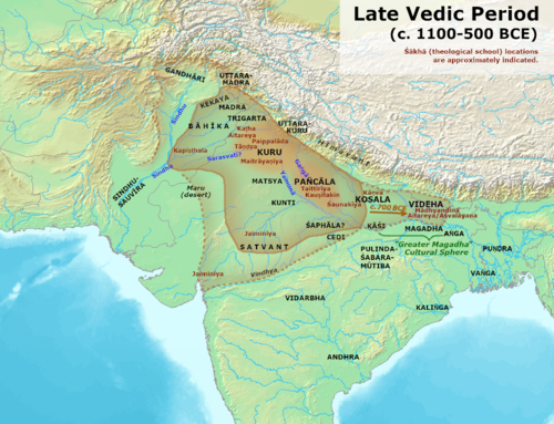


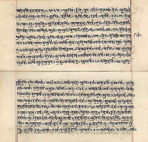


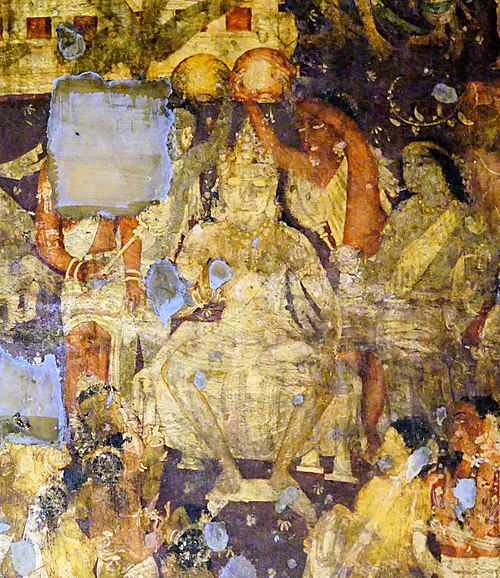


![Map of Kuru Kingdom. This is my work based on Raychaudhuri, Hemchandra (1953) Political History of Ancient India: From the Accession of Parikshit to the Extinction of Gupta Dynasty, University of Calcutta Background from [1]](https://upload.wikimedia.org/wikipedia/commons/thumb/a/a9/Map_of_Kuru_Kingdom.jpg/500px-Map_of_Kuru_Kingdom.jpg)


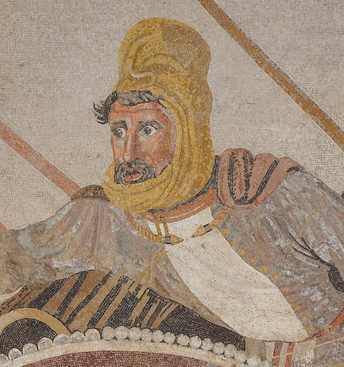

![Maurya Empire conceptualized as a network of cities. Based on File:Maurya Empire, c.250 BCE.png, which was made by Avantiputra7. Uncontrolled areas Original map, with large uncontrolled areas, based on: Kulke and Rothermund, A History of India. Network based on Smith (2005), Networks, Territories, and the Cartography of Ancient States, Annals of the Association of American Geographers. 95 (4): 832–849. Neywork of core areas and trade and communication routes Maurya Empire as a network of core areas connected by communication and trade routes: Smith (2005), Networks, Territories, and the Cartography of Ancient States" (PDF). Annals of the Association of American Geographers. 95 (4): 832–849 Coningham and Young (2015), The Archaeology of South Asia: From the Indus to Asoka, c.6500 BCE–200 CE, Cambridge University Press, following Smith's example. Gedrosia Ceded territory of Gedrosia based on Smith (1914) and Tarn (1922), who limit the ceded territory to the Malin mountain range (Hingol river). Kosmin, Paul J. (2014), The Land of the Elephant Kings Space, Territory, and Ideology in the Seleucid Empire, Harvard University Press, p.16: "Desert of Gedrosia [...] was left an unclaimed wilderness." Lower Indus Valley Coningham & Young, p.452-453, question the extent of control over the lower Indus Valley and eastern Afghanistan, noting that "a growing number of of researchers would now agree that the Ashokan edicts may have represented 'an area of maximum contact rather than streamlined bureacrayic control'." Allchin, F. R. (1995). "The Mauryan State and Empire". In Allchin, F. R. (ed.). The Archaeology of Early Historic South Asia: The Emergence of Cities and States. Cambridge University Press. pp. 183–221; p.208 also notes the absence of major cities in the lower Indus valley. Malcolm Robert Haig (1894), The Indus Delta Country: A Memoir, Chiefly on Its Ancient Geography and History, p.24: "the general rising of the northern peoples headed by Chandragupta, the founder of the Maurya dynasty of Pataliputra, followed in rapid succession. The Lower Indus Valley now became free from foreign rule, and the local chiefs were no doubt left to their own devices. Nominally the territory may have been a dependency of the Mauryan kingdom, but, separated from the main body of that kingdom by a wide expanse of desert, and at a vast distance from the capital on the Ganges, its tie of allegiance must have been of the slightest. This independence, or semi-independence, lasted under no doubt varying degrees of definiteness […] till […] Demetrius, in the second century B.C., invaded Patalene in force and completely subjected it to Bactria." Gujarat Chakrabarty (2010), p.29: "We are assuming that the basic historical-geographical configuration of the Magadhan power was achieved before the beginning of the Maurya dynasty, whose founder Chandragupta Maurya simply added to it the stretch from the Indus valley to the southern foot of the Hindukush, giving the Mauryan India a strong foothold in the Oxus to the Indus interaction zone of Indian history. The evidence is in some cases, as in the cases of Gujarat, Bengal, and Assam, shadowy, but if Chandragupta had undertaken expeditions in these directions, there would have been echoes of these expeditions in the literary traditions." Traditionial map File:Ashoka Maurya Empire.png For 'traditional' maps, which exaggerate the territory of the Mauryan empire, see File:Ashoka Maurya Empire.png, which has a neat overview of sources and maps describing and portraying this 'maximalized extent'.](https://upload.wikimedia.org/wikipedia/commons/thumb/2/2f/Maurya_Empire%2C_c.250_BCE_network_model_v01.png/500px-Maurya_Empire%2C_c.250_BCE_network_model_v01.png)